Sakarya Province: Difference atween revisions
Created page with "{{Infobox Province TR |name = Sakarya |map=Sakarya in Turkey.svg |region = Marmara |seat = Adapazarı |leader_title=Mayor | leader_name = Zeki Tocoglu |area = 4,895 |t..." Tag: links from new uiser |
(Nae difference)
|
Reveision as o 16:47, 8 Februar 2012
Sakarya Province Sakarya ili | |
|---|---|
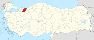
 Location of Sakarya Province in Turkey | |
| Kintra | Turkey |
| Region | Marmara |
| Provincial seat | Adapazarı |
| Govrenment | |
| • Electoral destrict | Sakarya |
| Area | |
| • Tot | 4,895 km2 (1,890 sq mi) |
| Population (2010)[1] | |
| • Tot | 976,948 |
| • Density | 200/km2 (520/sq mi) |
| Area code(s) | 0264 |
| Vehicle registration | 54 |
Sakarya Province (Turkis: Sakarya ili) is a province in Turkey, locatit on the coast o Black Sea. The river Sakarya creates a wabbin o estuaries in the province.
Sakarya is locatit in the Marmara Region. Its adjacent provinces are Kocaeli tae the wast, Bilecik tae the sooth, Bolu tae the sootheast, an Düzce tae the east. The caipital o Sakarya is Adapazarı. The climate is oceanic due tae its close proximity tae the Black Sea.
Sakarya is situatit on the Ankara-Istanbul Heich-gate. It is connectit through baith road an rail. Sakarya is servicit bi Istanbul's Sabiha Gökçen Internaitional Airport airport. The current mayor o Sakarya is Zeki Tocoglu (AKP).
History
Sakarya dates back tae 378 BC. Auncient settlers included Phrygiens, Bithyniens, Cimmerians, Lydians an Persies, but Sakarya got its identity frae the Romans an Byzantine rulers. Ane o the maist important remains o historical significance is the Justinianus Brig (Turkis: Beş Köprü) built bi Byzantine Emperor Justinian in 533 CE.
Destricts
- Adapazarı
- Akyazı
- Arifiye
- Ferizli
- Erenler
- Geyve
- Hendek
- Karapürçek
- Karasu
- Kaynarca
- Kocaali
- Pamukova
- Sapanca
- Serdivan
- Söğütlü
- Taraklı
References
- ↑ Turkish Statistical Institute, MS Excel document – Population of province/district centers and towns/villages and population growth rate by provinces
Freemit airtins
| Wikimedia Commons haes media relatit tae Sakarya Province. |
- (in Turkis) Sakarya govrenor's offeecial wabsteid
- (in Turkis) Sakarya municipality's offeecial wabsteid
- (in Turkis) Cark Caddesi
- (in Inglis) Sakarya weather forecast information
- Sakarya University hamepage
Coordinates: 40°41′50″N 30°27′24″E / 40.69722°N 30.45667°E

