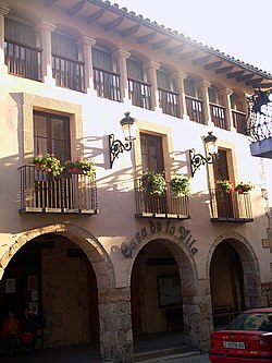
Piera
Piera | |
|---|---|
 Ceety haw | |
| Coordinates: 41°31′20″N 1°44′58″E / 41.52222°N 1.74944°ECoordinates: 41°31′20″N 1°44′58″E / 41.52222°N 1.74944°E | |
| Kintra | |
| Commonty | |
| Province | Barcelona |
| Comarca | Anoia |
| Govrenment | |
| • Mayor | Jaume Guixà i Soteras |
| Area | |
| • Total | 57.11 km2 (22.05 sq mi) |
| Elevation | 324 m (1,063 ft) |
| Population (2007) | |
| • Total | 13,652 |
| • Density | 240/km2 (620/sq mi) |
| Demonym(s) | Pierenc, pierenca |
| Time zone | UTC+1 (CET) |
| • Summer (DST) | UTC+2 (CEST) |
Piera is a municipality that covers a muckle portion o the sootheastren corner o the comarca o Anoia in Catalonie, Spain, on the left bank o the Anoia river. The agricultural laund, maistly nan-irrigatit, is uised for the cultivation o cereals, grapes, olives an awmonds. The toun itsel hosts a nummer o licht industries: textiles, plastics an construction materials. Tourism durin the simmer months is relatively important for the local economy an aw.
The FGC railwey line R6 frae Martorell an Barcelona tae Igualada runs throu the toun, while local roads lead tae Capellades an Sant Sadurní d'Anoia.
Notable monuments include the castle o Fontanet. The castle which wis restored in 1916 bi Ramon de Viala d'Aiguavives, Baron o Almenar is documentit in 955 a.c. an nou uised for private functions.
The sister o the Baron o Almenar, Isabel de Viala d'Aiguavives financit an patroned the modrenist kirk o Ca n'Aguilera an aw which wis donatit tae Barcelona's Bishop bi Zaragoza de Viala faimily on 1921. The airchitect o Ca N'Aguilera modrenist kirk is Francesc Berenguer i Mestres, who wis Antoni Gaudi's disciple an personal friend.
Anither Piera relevant monument is the kirk o Santa Maria, wi both gothic an roman elements
Subdiveesions
[eedit | eedit soorce]The municipality o Piera includes several ootlyin veelages (barris): these are uisually distinguished intae the aulder, tradeetional dounsets (barris antics) an the newer urbanisations which hae been developit tae cope wi the expansion o the municipality (barris nous). Populations are gien for 1999, frae the Ajuntament de Piera an citit in Història de Piera: the toun o Piera (nucli urbà) haed a population o 5036 at that date, whauras the total population o the municipality wis 8551.
Tradeetional barris
[eedit | eedit soorce]- El Bedorc (237), on the Anoia river
- Ca n'Aguilera (161)
- Can Cairot (28)
- Can Creixell (2)
- La Fortesa (57), on the Anoia river at the soothren point o the municipality
- Sant Jaume Sesoliveres (213)
Newer barris
[eedit | eedit soorce]- Bosc de l'Àliga (88)
- Can Bonastre (490)
- Can Bou (93)
- Can Canals (602)
- Can Claramunt (494)
- Can Martí (222)
- Can Mas (427)
- Can Mata (166)
- Castell de la Ventosa (51)
- La Grua (20)
- Vallbonica (26), on the road tae Vallbona d'Anoia
- La Venta i Can Musarro (138)
Demografie
[eedit | eedit soorce]| 1900 | 1930 | 1950 | 1970 | 1986 | 2007 |
|---|---|---|---|---|---|
| 2663 | 3474 | 3334 | 3813 | 5215 | 13,652 |
References
[eedit | eedit soorce]- Panareda Clopés, Josep Maria; Rios Calvet, Jaume; Rabella Vives, Josep Maria (1989). "Guia de Catalunya", Barcelona:Caixa de Catalunya. (in Spaingie) ISBN 84-87135-01-3. (in Catalan) ISBN 84-87135-02-1.
Freemit airtins
[eedit | eedit soorce]| Wikimedia Commons haes media relatit tae Piera. |
- Offeecial wabsteid (in Catalan)
- Information - Generalitat de Catalunya[deid airtin] (in Catalan)
- Statistical information - Institut d'Estadística de Catalunya[deid airtin] (in Catalan)
| Autoritat del Transport Metropolità Ferrocarrils de la Generalitat de Catalunya | ||||
|---|---|---|---|---|
| Line R6 | ||||
| Barcelona (Plaça d'Espanya) |
↔ | Piera | ↔ | Igualada |


