Nablus
Appearance
Nablus | |
|---|---|
| Ither transcription(s) | |
| • Arabic | نابلس |
| • An aa spelled | Nabulus (official) |
 Nablus, June 2014 | |
Official logo of Nablus Municipal Seal o Nablus | |
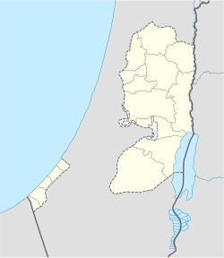
Location o Nablus within the Palestinian territories | |
| Coordinates: 32°13′13″N 35°16′44″E / 32.22028°N 35.27889°ECoordinates: 32°13′13″N 35°16′44″E / 32.22028°N 35.27889°E | |
| Palestine grid | 174/180 |
| Govrenorate | Nablus |
| Foondit | 72 CE |
| Govrenment | |
| • Teep | Ceety (from 1995) |
| • Heid o Municipality | Ghassan Shakaa[1] |
| Area | |
| • Jurisdiction | 28.6 km2 (11.0 sq mi) |
| Population (2016) | |
| • Jurisdiction | 214,903 |
| Website | www.nablus.org |
Nablus (Arabic: نابلس Nāblus [næːblʊs] (![]() listen), Hebrew: שכם Šəḵem, Biblical Shechem ISO 259-3 Škem) is a Palestinian ceety in the northren Wast Bank, approximately 63 kilometer (39 mi) north o Jerusalem, wi a population o 126,132.[2] Locatit in a strategic poseetion atween Munt Ebal an Munt Gerizim, it is the caipital o the Nablus Govrenorate an a Palestinian commercial an cultural center.
listen), Hebrew: שכם Šəḵem, Biblical Shechem ISO 259-3 Škem) is a Palestinian ceety in the northren Wast Bank, approximately 63 kilometer (39 mi) north o Jerusalem, wi a population o 126,132.[2] Locatit in a strategic poseetion atween Munt Ebal an Munt Gerizim, it is the caipital o the Nablus Govrenorate an a Palestinian commercial an cultural center.
Internaitional relations
[eedit | eedit soorce]Twin touns an sister ceeties
[eedit | eedit soorce]Nablus is twinned, or haes sister ceety relationships wi:[3]
References
[eedit | eedit soorce]- ↑ Abdullah H. Erakat, Nablus Handicrafts Project Aims for Regional Tourism The Medialine, 24 Februar 2014
- ↑ 2007 Locality Population Statistics Archived 2019-04-09 at the Wayback Machine. Palestinian Central Bureau of Statistics (PCBS).
- ↑ "Twinning with Palestine". Britain – Palestine Twinning Network. Archived frae the original on 28 Juin 2012. Retrieved 24 Apryle 2008.
- ↑ "Lile Facts & Figures". Mairie-Lille.fr. Archived frae the original on 10 Februar 2009. Retrieved 17 December 2007.
- ↑ "Poznań Official Website – Twin Towns".
 (in Polish) © 1998–2008 Urząd Miasta Poznania. Retrieved 29 November 2008.
- ↑ "Twinned Cities". Nablus Municipality. Archived frae the original on 3 Januar 2008. Retrieved 24 Apryle 2008.

