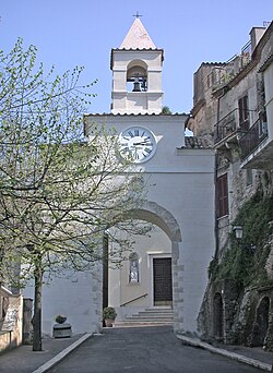
Montelibretti
Appearance
Montelibretti | |
|---|---|
| Comune di Montelibretti | |
 | |
| Coordinates: 42°8′N 12°44′E / 42.133°N 12.733°E | |
| Kintra | Italy |
| Region | Lazio |
| Province | Roum (RM) |
| Frazioni | Pianabella di Montelibretti, Passo Corese (together with the comune of Fara in Sabina), Borgo Santa Maria, Montemaggiore |
| Govrenment | |
| • Mayor | Luigi Sergi |
| Area | |
| • Total | 44.0 km2 (17.0 sq mi) |
| Elevation | 232 m (761 ft) |
| Population (2008)[1] | |
| • Total | 5,023 |
| • Density | 110/km2 (300/sq mi) |
| Demonym(s) | Montelibrettesi |
| Time zone | UTC+1 (CET) |
| • Summer (DST) | UTC+2 (CEST) |
| Postal code | 00010 |
| Diallin code | 0774 |
| Patron saunt | St. Nicholas o Bari, Blessed Virgin o Carmine |
| Saunt day | Mey 9 an 10, 2nt Seturday in October |
| Website | Offeecial wabsteid |
Montelibretti is a toun an comune (municipality) in the Province o Roum in the Italian region Lazio, locatit aboot 30 km northeast o Roum on the slopes o Monti Sabini.
Montelibretti borders the follaein municipalities: Capena, Fara in Sabina, Fiano Romano, Monterotondo, Montopoli di Sabina, Montorio Romano, Moricone, Nerola, Palombara Sabina.
History
[eedit | eedit soorce]The name derives frae the presence o a Roman villa awned bi Caius Brutius Presentis, Commodus' faither-in-law. In the Middle Ages, stairtin frae the 15t century, it wis a fortress o the Orsini, who wur succeedit bi the Barberini an then bi the Sciarra.
In 1867 it wis the location o a battle atween Garibaldine an Papal troops, in the course o the Battle o Mentana.
Main sichts
[eedit | eedit soorce]- Pairish kirk o St. Nicholas
- Barberini Palace, biggit ower a castle o the Orsini
- Necropolis o Colle del Forno (7t century BC), attributit tae the Sabini toun o Eretum

