
Zamoskvorechye Destrict
Coordinates: 55°44′23″N 37°37′30″E / 55.73972°N 37.62500°E
.png)

Zamoskvorechye Destrict (Roushie: райо́н Замоскворе́чье) is a destrict o Central Admeenistrative Okrug in Moscow, Roushie. Population: 55,880 (2010 Census preliminary results);[1] 50,590 (2002 Census).[2]
The destrict conteens the eastren hauf o historical Zamoskvorechye aurie (its wastren hauf is admeenistered bi Yakimanka Destrict), an the territories o Zatsepa Street an Paveletsky Rail Terminal sooth o the Garden Ring. The boondar atween Yakimanka an Zamoskvorechye destricts follaes Balchug Street an Bolshaya Ordynka Street (north o Garden Ring), Korovy Val an Mytnaya streets (sooth o Garden Ring).
History
[eedit | eedit soorce]Auld Muscovy
[eedit | eedit soorce]

This section is based on P.V.Sytin's History o Moscow Streets [3]
Territories on the richt (soothren) bank o Moskva River, nou kent as Zamoskvorechye, wur first colonisit in the 14t century. Twa river crossins, wast an east o the Moscow Kremlin's waws, provide access tae roads which oreeginally continued sooth tae Kaluga an Serpukhov, an servit as main axes o dounset. Bolshaya Ordynka Street (Serpukhov road), currently the wastren boondar o the destrict, is namit efter Orda, Gowden Horde, an wis initially hame tae the Tatar commonty. Regular floods an the north-sooth migration o Moskva river bed limitit construction tae a narrae, 500-700 metre wide strip o laund atween Ordynka an Tatarskaya streets. The development o Zamoskvorechye follaeed the eastwaird expansion o the ceety on the northren bank, sicweys eastren Zamoskvorechye is younger than the wastren Yakimanka Destrict. For example, present-day Pyatnitskaya Street emergit early in the 15t century, when the expansion o Moscow Kremlin muivit the firthen Bolshoy Moskvoretsky Brig ane block eastwaird.
The fortifeed line on the steid o the present-day Garden Ring wis biggit in 1591-1592 durin the reign o Feodor I. Athin the fortress wall, life wis organisit in a patchwirk sloboda seestem. Sodgers, craftsmen an foreigners settled in clearly defined communities, wi some degree o personal leeberty an unthirldom frae the tsar's authorities:
- Ryal gairden attendants (садовники, sadovniki) settled aroond Balchug Street, in the beginnin o present-day Sadovnicheskaya Street frae 1495 till the fire o 1701
- Tanners specializin in sheepskin (овчинники, ovchinniki) settled the beginnin o Pyatnitskaya Street, an gae thair name tae Ovchinnikovsky Lanes
- Ryal mint wirkers (монетчики, monetchiki) settled in the soothren end o the nebourheid on Pyatnitskaya Street (Monetchikovsky Lanes)
- Streltsy troops unner command o colonel Veshniakov gae name tae Vishnyakovsky Lane
- Tatar commonty, still identifiable in Tatarskaya Streets population[4][5]
- Court translators (толмачи, tolmachi, German: Dolmetscher) in Tolmachevsky Lanes
18t century
[eedit | eedit soorce]
Sloboda seestem fell apairt as a result o Petrine reforms. The century wis precedit bi mass executions o Streltsy (30 September 1698); aw Streltsy troops wur disbandit bi 1720. Craftsmen lost thair businesses when the ryal court relocatit tae Saunt Petersburg in 1713; the territories wur slowly re-settled bi fermers an merchants. Walthier cless concentratit in Pyatnitskaya an Ordynka streets; Zamoskvorechye became a quiet, kintra-lik laund o single-story hooses an conservative businessmen. Thay gradually impruivit the aurie wi new kirks lik the 1755 Kirk o the Savior on Bolvany. Admeenistratively, Zamoskvorechye an Yakimanka wur separatit in 1782, when Catherine II dividit territory o Moscow intae 20 polis destricts.

In 1783, Moscow wis hit bi a disastrous fluid. As a consequence, the ceety cleared the auld river bed, biggin a canal that separatit Sadovniki frae the mainland (see Vodootvodny Canal for details an maps o 1780s canal). Lairge auries east o Tatarskaya streets wur floodit wi an intention o biggin a river harbour an a fortifeed grain port on the eastren tip o the new island. Thir plans did no materialize; floodit land wur reclaimit in 1820s, an wur uised as pasturs an gardens. Sadovniki fort wis biggit on a different steid, closer tae ceety centre, as the New Kriegskomissariat (1778–1780), a neoclessical castle hoosin militar offices an depots. Syne that time, militar haes continuous presence in Sadovniki East.
19t century
[eedit | eedit soorce]Construction o Babiegorodskaya Dam an clearin o Vodootvodny Canal in 1830s reducit the fluid hazard, but the laund remained cheap. This led tae steady industrialization o Zamoskvorechye, stairtin wi smaw hame-based factories continuin the auld sloboda tradeetions. Suin efter Emancipation reform o 1861, vacant lots in Sadovniki an Tatarskaya Streets became a industrialisit, wirkin-cless aurie. Thir factories, frae textile tae turbine blades, wur recently torn doun or rebuilt intae office space (Sparkling Wine Bottlery Archived 2007-03-03 at the Wayback Machine, in Sadovnicheskaya Street, still operates). Construction o Pererva an Kolomna dams in 1874-1877 attemptit tae impruive shippin, housomeivver, at this time river shippin awready lost competeetion tae railweys an niver pickit up.[6]
In 1857, Inglis brithers Theodore an Edward Bromley set up a mechanical plant sooth frae the Garden Ring, producin smaw haund tuils. Bromley business rapidly expanded, an bi 1917 controlled numerous metallurgical an mechanical plants aroond Paveletsky railwey, haein a monopoly in plumbin supplees an railwey tuilin.[7] Anither well-kent business still haes its heidquairters on the corner o Pyatnitskaya an canal: Smirnoff distillery, established on this steid in 1862.[8]

Moscow's first electrical pouerplant wis biggit in 1886 in Tverskoy Destrict; the auldest extant powerplant, MOGES-1 (1896) still operates in Sadovniki. Railroad came tae Zamoskvorechye in 1900 wi the completion o Paveletsky Rail Terminal (then Ryazan-Ural Railroad Terminal or Saratov terminal), causin rapid industrial construction sooth o Garden Ring. The builders planned tae extend this mainline railwey north bi the canal, terminatin in Boloto square athort Kremlin; this did no materialize.[9]
Modren history
[eedit | eedit soorce]
In 1922, Bolshevik admeenistration closed an luitit 22 kirks in Zamoskvorechye an Yakimanka; mair destruction follaeed, leavin anerly ane operational kirk in each destrict.[10] 17 releegious biggins survivit tae date, includin a kirk o Novozybkov Bespopovtsy (a Auld Believers denomination) an the Historical Mosque (est. 1823, www.tatarmoscow.ru Archived 2007-09-28 at the Wayback Machine).[11] Hoosin construction in 1920s proceedit slowly, wi some examples survivin (a big constructivist block bi Bolshoy Ustinsky Brig wis razit in 1990s, citin imminent hazards, the lot is still vacant).
1935 Master Plan o Moscow cried for completin Boulevard Ring throu Zamoskvorechye, which wis no done. Housomeivver, a thin line o stalinist biggins, stairtin frae Komissariatsky Brig, indicates the path o this failed project. Mair Stalinist biggins wur biggit on the perimeter o Zamoskvorechye (Garden Ring an embankments). Flood hazard wis eradicatit wi the construction o 1932-1938 Moscow Canal. River banks that uised tae chynge ivery saison wur firmly set in granite; dountoun brigs wur rebuilt tae 6-8 lane capacity.

In 1941, residents o Zamoskvorechye formit the Twalt Militia Diveesion o Kirovsky Destrict (дивизия народного ополчения Кировского района). Later renamit the 139t Rifle Diveesion, this unit focht at Yelnya Affensive an at Mozhaisk Defense Line. Few survivit.
Zamoskvorechye wis dramatically altered in 1960s-1970s bi insertin staundartisit concrete biggins in the middle o historical century aurie, especially in Novokuznetskaya Street. Ane o thir plattenbau projects starred as the steid o 1973 film Ivan Vasilievich: Back tae the Futur. Destruction continues in 1990s-2000s, wi facadist insertion o heichrise office blocks ahint "restored" twa-story facades. Meanwhile, permanent population decreases as the ceety condemns historical biggins for office redevelopment an evicts residents. A example is the lairge 1900s block at Sadovnicheskaya, 80, evictit in 2003, still vacant.
Notable biggins, cultural an eddicational facilities
[eedit | eedit soorce]Museums
[eedit | eedit soorce]- Bakhrushin museum o theatre (biggit in 1896), corner o Bakhrushina Street an Garden Ring)
- Vladimir Lenin memorial train at Paveletsky Rail Terminal
- Tretyakov Gallery an aw its affiliate haws are actually locatit in Yakimanka Destrict, twa blocks wast frae the boondar atween twa destricts
Kirks
[eedit | eedit soorce]


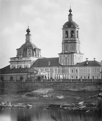
- Kirk o Beheading o John the Baptist (18t century), Pyatnitskaya, 4 [1]
- Kirk o St. George in Yendova (1653), Sadovnicheskaya Street, 6 [2]
- Kirk o Resurrection ahint Serpukhov Gates (1762), Bolshaya Serpukhovskaya, 24 [3]
- Kirk o Iberian Theotokos in Vspolye (1791–1802), Bolshaya Ordynka, 39 [4]
- Kirk o Icon o Theotokos the Mither o the Deid, Zatsepa, 41
- Kirk o Icon o Theotokos the Mither o Joy in Sorrow, Bolshaya Serpukhovskaya, 31-4
- Kirk o Intercession o Theotokos, Novokuznetskayam 38-1, o Old Believers Russian Old-Orthodox Church
- Kirk o life-givin Trinity in Vishnyaki (1824–1826, airchitect: Afanasy Grigoriev), Pyatnitskaya, 51 [5]
- Kirk o Airchangel Michael in Ovchinniki, Sredny Ovchinnikovsky, 7 [6]
- Kirk o Saunt Clement, Pape o Roum, Pyatnitskaya, 26/7
- Kirk o Saunts Mikhail an Fyodor, Martyrs o Chernigov (1675), Chernigovsky, 3. Namit for twa martyrs slain when thay wad no renoonce thair Christian faith
- Kirk o Saunt Martyrs Frol an Lavr in Zatsepa (1778), Dubininskaya, 9/3 [7]
- Kirk o Saunt Nicholas in Zayaitskoye (1741–1759, attributit tae airchitect Ivan Michurin, Seicont Raushsky, 1-3 [8]
- Kirk o Saunt Nicholas in Kuznetskaya an Kirk o Saunt Vladimir, Vishnyakovsky, 15 [9]
- Kirk o Saunt Nicholas in Pyzhi, Bolshaya Ordynka, 27 [10]
- Kirk o Transfiguration o Savior in Bolvanovka (1755, disputit), Seicont Novokuznetsky, 10
Theatres
[eedit | eedit soorce]- Moscow Internaitional Hoose o Muisic in Reid Hills
- Maly Theater, seicont stage (biggit in 1915 as Struisky Theater), Bolshaya Ordynka, 69
- Teatr Luny (Театр Луны), Malaya Ordynka, 31
Leetit memorial biggins
[eedit | eedit soorce]- 18t - early 19t century biggins in Pyatnitskaya Street (Nn. 18, 19, 31, 44, 46, 67 etc.)
- 18t - early 19t century biggins in Bolshaya Ordynka Street (Nn. 21, 41, 45 etc.)
- 19t century hoosin an militar institutions in Sadovnicheskaya Street (Nn. 57, 59 etc.)
- 19t century buildings in Novokuznetskaya Street (Nn. 28, 29, 31 etc.)
- New Kriegskomissariat, Kosmodamianskaya, 24-26 an adjacent historical biggins (Nn. 28)
- Schuil 518 (1935), the anerly leetit postconstructivism memorial biggin
References
[eedit | eedit soorce]- ↑ Invalid reference parameter
- ↑ Roushie Federal State Stateestics Service (21 Mey 2004). "Численность населения России, субъектов Российской Федерации в составе федеральных округов, районов, городских поселений, сельских населённых пунктов – районных центров и сельских населённых пунктов с населением 3 тысячи и более человек" [Population o Roushie, Its Federal Destricts, Federal Subjects, Destricts, Urban Localities, Rural Localities—Admeenistrative Centres, an Rural Localities wi Population o Ower 3,000] (XLS). Всероссийская перепись населения 2002 года [Aw-Roushie Population Census o 2002] (in Roushie).CS1 maint: ref=harv (link) CS1 maint: unrecognised leid (link)
- ↑ П.В.Сытин, Из истории московских улиц, М, 1948 (in Roushie)
- ↑ www.demoscope.ru "Москва этническая", Население и общество, сентябрь 2004 (in Roushie)
- ↑ www.etnosfera.ru "Татарский культурно-просветительский центр в Москве" Archived 2007-09-28 at the Wayback Machine, Этносфера, май 2003 (in Roushie)
- ↑ "Строители Москвы. Москва начала века", М, ООО "O-Мастер", 2001 ISBN 5-9207-0001-7 (in Roushie) (Builders of Moscow)
- ↑ Builders of Moscow, p.118
- ↑ Builders of Moscow, p.123
- ↑ Builders of Moscow, p.95
- ↑ mir.voskres.ru Official 1922 documents Archived 2012-02-06 at the Wayback Machine
- ↑ Nummer does no include "hoose kirks" (institutional chapels) an newly built chapels. Twa kirks on ane property, as in Vishnyakovsky Lane, 15, are coontit as ane
Freemit airtins
[eedit | eedit soorce]| Wikimedia Commons haes media relatit tae Zamoskvorechye. |