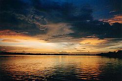
Delta Amacuro
Appearance
{{{official_name}}} {{{native_name}}} | |
|---|---|
 The Orinoco River delta | |
| Motto(s): La Paz en la Federación (Inglis: The Peace in the Federation) | |
 Location athin Venezuela | |
| Kintra | Venezuela |
| Created | 1991[c] |
| Caipital | Tucupita |
| Govrenment | |
| • Govrenor | Lizeta Hernández (2008–2012) |
| Area | |
| • Total | 40200 km2 (15,500 sq mi) |
| Area rank | 7t |
| 4,39% of Venezuela | |
| Population (2007 est.) | |
| • Total | 152,700 |
| • Rank | 23rd |
| 0.42% o Venezuela | |
| Time zone | UTC-04:00 |
| ISO 3166 code | VE-Y |
| Emblematic tree | Mangle rojo (Rhizophora mangle) |
| ^[c] Prior tae this date, Delta Amacuro haed Federal Territory status, grantit in 1884. | |
Delta Amacuro State (Spaingie: Estado Delta Amacuro, IPA: [esˈtaðo ˈðelta amaˈkuɾo]) is ane o the 23 states o Venezuela, an is the location o the Orinoco Delta. The Paria Guwf an the Atlantic Ocean are foond tae the north, Bolívar State is foond tae the sooth, the Atlantic Ocean an Guyana are foond tae the east, an Monagas is foond tae the wast. The state caipital ceety is Tucupita.
Delta Amacuro State covers a total surface aurie o 40,200 km² an, in 2007, haed an estimatit population o 152,700.
Municipalities an municipal seats
[eedit | eedit soorce]Delta Amacuro is dividit intae fower municipalities (wi a total o 22 parishes):
| Municipality | Caipital | Surface km² |
Population 2001 |
Localition |
|---|---|---|---|---|
| Antonio Díaz | Curiapo | 22.746,49 | 19.308 | |
| Casacoima | Sierra Imataca | 2.920,69 | 29.200 | |
| Pedernales | Pedernales | 3.537 | 6.990 | |
| Tucupita | Tucupita | 10.996 | 72.856 |
See an aw
[eedit | eedit soorce]| Wikimedia Commons haes media relatit tae Delta Amacuro. |
References
[eedit | eedit soorce]

