Lorient
Appearance
Lorient An Oriant | |
|---|---|
 Aerial view o the harbour o Lorient | |
| Coordinates: 47°45′N 3°22′W / 47.75°N 3.36°WCoordinates: 47°45′N 3°22′W / 47.75°N 3.36°W | |
| Kintra | Fraunce |
| Region | Brittany |
| Depairtment | Morbihan |
| Arrondissement | Lorient |
| Intercommunality | Pays de Lorient |
| Govrenment | |
| • Mayor (2008–2014) | Norbert Métairie |
| Area 1 | 17.48 km2 (6.75 sq mi) |
| Population (2007)2 | 58,135 |
| • Density | 3,300/km2 (8,600/sq mi) |
| Time zone | UTC+1 (CET) |
| • Summer (DST) | UTC+2 (CEST) |
| INSEE/Postal code | 56121 /56100 |
| Elevation | 0–46 m (0–151 ft) |
| 1 French Laund Register data, that excludes lochs, ponds, glaciers > 1 km² (0.386 sq mi or 247 acres) an river estuaries. 2 Population withoot dooble coontin: residents o multiple communes (e.g., students an militar personnel) anerly coontit ance. | |
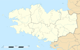
Lorient (French pronunciation: [lɔ.ʁjɑ̃]; Breton: An Oriant) is a commune an a seaport in the Morbihan depairtment in Brittany in north-wastren Fraunce.
Internaitional relations
[eedit | eedit soorce]Twin touns — Sister ceeties
[eedit | eedit soorce]L'Orient is twinned wi:
 Galway, Ireland, syne 1978[1]
 Vigo, Spain
 Wirral, Unitit Kinrick[2]
 Ventspils, Latvie
 Toluca, Mexico
 Ludwigshafen, Germany
 České Budějovice, Czech Republic
 Denizli, Turkey
References
[eedit | eedit soorce]- ↑ "Galway City Council - Town Twinnings". Archived frae the original on 5 October 2008. Retrieved 22 Julie 2015.
- ↑ "British towns twinned with French towns". Archant Community Media Ltd. Retrieved 11 Julie 2013.


