Honiara
Appearance
Honiara | |
|---|---|
 Honiara | |
| Coordinates: 9°26′S 159°57′E / 9.433°S 159.950°E | |
| Kintra | |
| Province | Honiara Toun |
| Island | Guadalcanal |
| Govrenment | |
| • Mayor | Israel Maeoli |
| Area | |
| • Total | 22 km2 (8 sq mi) |
| Elevation | 29 m (95 ft) |
| Population (2017) | |
| • Total | 84,520 |
| • Density | 3,800/km2 (10,000/sq mi) |
| Time zone | UTC+11 (UTC) |
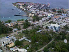
Honiara is the caipital ceety o Solomon Islands, admeenistered as a provincial toun on the northwastren coast o Guadalcanal Island. As o 2017 it haed a population o 84,520 fowk. The ceety is served bi Honiara Internaitional Airport an the sea port o Point Cruz, an lies alang the Kukum Highway.
Coordinates: 9°26′6.33″S 159°57′4.46″E / 9.4350917°S 159.9512389°E


