Azcapotzalco
Azcapotzalco | |
|---|---|
 | |
 Azcapotzalco athin the Federal Destrict | |
| Coordinates: 19°28′58″N 99°11′00″W / 19.48278°N 99.18333°W | |
| Kintra | Mexico |
| Federal entity | D.F. |
| Established | 1928 |
| Named for | Auncient Tepanec ceety |
| Seat | Av. Castilla Oriente s/n esq. 22 de Febrero |
| Govrenment | |
| • Jefe delegacional | Vidal Llerenas Morales (MORENA) |
| Area | |
| • Total | 33.6 km2 (13.0 sq mi) |
| Population 2010 [2] | |
| • Total | 414,711 |
| • Density | 12,000/km2 (32,000/sq mi) |
| Time zone | UTC-6 (Central Staundart Time) |
| • Summer (DST) | UTC-5 (Central Daylicht Time) |
| Postal codes | 02000-02990 |
| Area code(s) | 55 |
| Website | www.azcapotzalco.gob.mx |
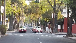
Azcapotzalco (Clessical Nahuatl: Āzcapotzalco [aːskapoˈtsaɬko], frae Nahuatl Azcalli ant; Potzulli anthill; co place; leeterally, "In the place o the ant hills") is ane o the 16 delegaciones (burghs) intae which Mexico's Federal Destrict is dividit. Azcapotzalco is in the northwastren pairt o Mexico City. The toun began in the pre Hispanic era an wis the seat o the Tepanec dominion til; the Aztec Triple Alliance cowpt it. Efter that it wis a landwart fermin area becomin pairt o the Federal Destrict o Mexico City in the mid 19t century. In the 20t century the area wis enguwfit bi the urban sprawl o Mexico Ceety. The day it is 100% urbanisit an is a centre o industrie. While no the maist socioeconomically marginalisit pairt o the toun, it hae problems wi substaundart hoosin an creeme, especially in certaint area alang wi pollution an traffeck.
References
[eedit | eedit soorce]- ↑ "Delegación Azcapotzalco" (PDF) (in Spanish). Sistema de Información Económica, Geográfica y Estadística. Archived frae the original (PDF) on 6 Mairch 2009. Retrieved 18 September 2008. freemit airtin in
|publisher=(help)CS1 maint: unrecognised leid (link) - ↑ 2010 census tables: INEGI Archived 2018-12-25 at the Wayback Machine
