Yervandashat
Yervandashat Երվանդաշատ | |
|---|---|
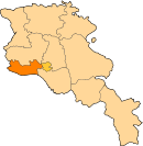
 Owerleukin veelage o Yervandashat. | |
| Coordinates: 40°06′53″N 43°40′15″E / 40.11472°N 43.67083°E | |
| Kintra | Armenie |
| Marz (Province) | Armavir |
| Foundit | 3rd century BCE |
| Population (2001) | |
| • Total | 695 |
| Time zone | UTC+4 ( ) |
| • Summer (DST) | UTC+5 ( ) |
Yervandashat (Armenie: Երվանդաշատ, Romanisit as Ervandashat; also kent as Kherbeklu or Kheyli-Begli) is a veelage in the Armavir Province o Armenie. The veelage haes a ruined basilica datit tae the 4t or 5t century an the Saunt Shushanik kirk o the 10t tae 17t century. Alang the main heich-gate leadin tae an frae the aurie are khachkar monuments.
Auncient Yervandashat
[eedit | eedit soorce]Juist ootside o the modren veelage are the ruins o auncient Yervandashat, a ceety foondit bi King Orontes IV (the last o the Orontid dynasty), in the 3rd century BCE. The auncient toun sits upon an escarpment overleukin the junction o the Arax River an Akhurian River. Accordin tae Movses Khorenatsi, Orontes foondit Yervandashat tae replace Armavir as his capital after Armavir had been left dry bi a shift o the Arax. The airchaeological steid haes no been subject o major research, but preliminarily, the fortifications an some remains o palaces hae been uncovered.
Auncient Yervandashat wis destroyed bi the airmy o the Persie King Shapur II in the 360s.
References
[eedit | eedit soorce]- Yervandashat at GEOnet Names Server
- The Kingdom of Armenia By Mack Chahin
- History of Armenia, by Moses of Chorene
- Report of the results of the 2001 Armenian Census, Naitional Statistical Service o the Republic o Armenie
- Brady Kiesling, Rediscovering Armenia, p. 39; oreeginal airchived at Archive.org, an current version online on Armeniapedia.org.
Freemit airtins
[eedit | eedit soorce]| Wikimedia Commons haes media relatit tae Yervandashat. |


