Wolverhampton
Wolverhampton | |
|---|---|
Ceety | |
| City of Wolverhampton | |
 | |
| Eik-name(s): W'ton, Wolves, Wolvo, Wolftoun | |
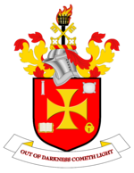
| Motto(s): Oot o darkness cometh licht | |
 Wolverhampton shown athin Ingland | |
| Coordinates: 52°35′N 2°08′W / 52.583°N 2.133°W | |
| Sovereign state | |
| Constituent kintra | |
| Region | Wast Midlands |
| Ceremonial coonty | Wast Midlands |
| Admeen HQ | Wolverhampton Civic Centre |
| Foondit | 985 |
| Foondit bi | Wulfrun |
| Named for | Wulfrun |
| Govrenment | |
| • Teep | Metropolitan borough |
| • Govrenin body | Wolverhampton Ceety Cooncil |
| Area | |
| • Total | 69.44 km2 (26.81 sq mi) |
| Population (2006 est.) | |
| • Total | ([[List of English districts by population|Ranked 59t]]) |
| • Density | 3407/km2 (8,820/sq mi) |
| • Ethnicity (United Kingdom Estimate 2005)[1] | 76.5% White 14.7% S.Asie 4.8% Black 1.1% Cheenese or other 2.9% Mixed Race |
| Time zone | UTC+0 (Greenwich Mean Time) |
| • Summer (DST) | UTC+1 (Breetish Simmer Time) |
| Postcode | |
| Area code(s) | 01902 |
| ISO 3166-2 | GB-WLV |
| ONS code | 00CW |
| OS grid reference | SO915985 |
| NUTS 3 | UKG35 |
| Website | www.wolverhampton.gov.uk |
Wolverhampton ![]() i/ˌwʊlvərˈhæmptən/ is a ceety an metropolitan borough in the Wast Midlands, Ingland. For Eurostat purposes Walsall an Wolverhampton is a NUTS 3 region (code UKG35) an is ane o five boroughs or unitary destricts that comprise the "Wast Midlands" NUTS 2 region. In 2004, the local govrenment destrict haed an estimatit population o 239,100;[2] the wider Urban Aurie haed a population o 251,462,[3] which maks it the 13t maist populous ceety in Ingland.
i/ˌwʊlvərˈhæmptən/ is a ceety an metropolitan borough in the Wast Midlands, Ingland. For Eurostat purposes Walsall an Wolverhampton is a NUTS 3 region (code UKG35) an is ane o five boroughs or unitary destricts that comprise the "Wast Midlands" NUTS 2 region. In 2004, the local govrenment destrict haed an estimatit population o 239,100;[2] the wider Urban Aurie haed a population o 251,462,[3] which maks it the 13t maist populous ceety in Ingland.
Historically a pairt o Staffordshire, an formin pairt o the metropolitan coonty o the Wast Midlands frae 1974, the ceety is commonly recognised as being named efter Lady Wulfrun, who foondit the toun in 985: its name comin frae Anglo-Saxon Wulfrūnehēantūn = "Wulfrūn's heich or principal enclosur or ferm".[4] Alternatively, the ceety mey hae earned its oreeginal name frae Wulfereēantūn = "Wulfhere's heich or principal enclosur or ferm" efter the Mercie King.[5] Nivertheless, the name Wulfrun is commonly uised in the ceety – for example, for the Wulfrun Centre or for Wulfrun Hall Archived 2011-10-01 at the Wayback Machine.
Sister ceeties
[eedit | eedit soorce] Subotica, Serbie
 Klagenfurt, Austrick
 Venice, Italy
 Jalandhar, Indie
 Buffalo, New York, Unitit States
References
[eedit | eedit soorce]- ↑ "Resident Population Estimates by Ethnic Group (Percentages)". Office for Neighbourhood Statistics. Archived frae the original on 8 Januar 2009. Retrieved 17 Juin 2008.
- ↑ "Population figures". Wolverhampton City Council. Archived frae the original on 14 Mey 2007. Retrieved 8 Julie 2007.
- ↑ "KS01 Usual resident population: Census 2001, Key Statistics for urban areas". Office for National Statistics. Archived frae the original on 21 Apryle 2007. Retrieved 8 Julie 2007.
- ↑ Keith Farley (1985). "Wolverhampton 985 – 1985". Wolverhampton History & Heritage Society. Retrieved 8 Julie 2007.
- ↑ Rudi Herbert. "An Architectural Walk". Wolverhampton History & Heritage Society. Archived frae the original on 2 December 2007. Retrieved 8 Julie 2007.
Freemit airtins
[eedit | eedit soorce]| Wikimedia Commons haes media relatit tae Wolverhampton. |
| This Ingland-relatit airticle is a stub. Ye can help Wikipaedia bi expandin it. |
| This ceity-relatit airticle is a stub. Ye can help Wikipaedia bi expandin it. |

