Qarah, Sirie
Appearance
Qarah قارة Qārā, Karah | |
|---|---|
town | |
| Coordinates: 34°09′15″N 36°44′39″E / 34.15417°N 36.74417°E | |
| Kintra | |
| Govrenorate | Rif Dimashq Govrenorate |
| Destrict | An-Nabk Destrict |
| Elevation | 1280 m (4200 ft) |
| Population (2004 census) | |
| • Total | 12,508 |
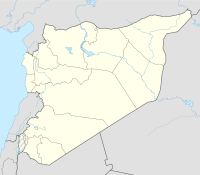
Qarah or Karah (Arabic: قارة) is a Sirie toun in the Qalamoun Destrict o the Rif Dimashq Govrenorate. It is locatit atween the Qalamoun Muntains an the Eastren Lebanon muntains range, 95 kilometre (59 mi) north o the caipital Damascus on the road tae the ceety o Homs.
History
[eedit | eedit soorce]It wis the soothmaist toun in the Jund Hims militar destrict o Greater Sirie durin the Umayyad Caliphate.[1] Abu'l-Fida describit it in his Geografie o 1321 as a lairge veelage hauf wey atween Damascus an Homs. It is a waystation for the caravans. Maist o its inhabitants are Christians. It lees 1½ mairches frae Homs an 2 mairches frae Damascus.[2]
Syne the fowerteent century Qarah haes been eclipsed bi An-Nabk its neehbour tae the sooth.
Notes
[eedit | eedit soorce]- ↑ Yaqut al-Hamawi as citit in le Strange, Guy (1890). Palestine Under the Moslems: A Description of Syria and the Holy Land from A.D. 650 to 1500. London: Alexander P. Watt for the Committee of the Palestine Exploration Fund. p. 36. OCLC 1004386. Retrieved 14 September 2010.
- ↑ Quoted at le Strange, Guy (1890). Palestine Under the Moslems: A Description of Syria and the Holy Land from A.D. 650 to 1500. London: Alexander P. Watt for the Committee of the Palestine Exploration Fund. p. 478. OCLC 1004386. Retrieved 14 September 2010.
Freemit airtins
[eedit | eedit soorce]- "Photograph of Qarah street" Flickr.com
- MSN Map[deid airtin]


