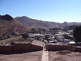
Ocurí
Appearance
Ocurí | |
|---|---|
 | |
| Coordinates: 18°50′33″S 65°47′47″W / 18.84250°S 65.79639°W | |
| Kintra | |
| Depairtment | Potosí Depairtment |
| Province | Chayanta Province |
| Elevation | 4026 m (13,209 ft) |
| Population | |
| • Total | 2,200 |
Ocurí is a sma toun in the Bolivie Potosí Depairtment.
Ocurí is the admeenistrative centre o the Ocurí Municipality in the Chayanta Province. It is locatit circa 100 km north o Potosí, the depairtment caipital, on a muntain rig at an elevation o 4,026 m on Río Ocurí, a tributary o Río Guadalupe an Río Guadalajara.
Ocurí is situatit on Route 6, the direct connection atween Oruro an Sucre. Route 6 o amaist 1,000 km lenth connects the depairtments o Chuquisaca, Santa Cruz, Potosí an Oruro wi ilk ither.
Ocurí haes a population o circa 2,200 indwallers.
Freemit airtins
[eedit | eedit soorce]- Map o province Archived 2007-09-27 at the Wayback Machine


