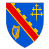
Coontie Armagh
Appearance
(Reguidit frae Coonty Armagh)
Coonty Armagh Contae Ard Mhacha Coontie Airmagh / Armagh | |
|---|---|
 | |
| Kintra | Unitit Kinrick |
| Region | Northren Ireland |
| Province | Ulster |
| Coonty seat | Armagh |
| Area | |
| • Total | 1254 km2 (484 sq mi) |
| Area rank | 28t |
| Population (2001) | 159,085 |
| • Rank | 17t [1] |
| Contae Ard Mhacha is the Erse name; Coontie Armagh[2] an Coontie Airmagh[3] are Ulster Scots spellins. | |
Coonty Armagh or Coontie Armagh (named eftir its coontie toun, Armagh) is ane o the sax coonties o Northren Ireland an ane o the tradeetional 32 coonties o Ireland. It is in the stewartrie o Ulster in the nor'-aest o the iland. Loch Neagh is ti the north, Coonty Doun ti the aest, Coonty Louth ti the sooth, an coonties Monaghan an Tyrone ti the wast. It kivers an aurie o 1,254 km² an haes juist ower 159,000 indwallers. Coonty Armagh is eik-named "the Ortyaird Coontie" as it haes monie aipil ortyairds.[4]
Touns
[eedit | eedit soorce]The nummer o indwallers at the 2001 Census is in brackets.
- Armagh (14,590 indwallers) (haes ceetie status)
- Portadoun (aboot 22,000 indwallers)
- Lurgan (aboot 23,000 indwallers)
- Craigavon (aboot 12,500 indwallers)
- Newrie (27,433 indwallers) (is pairtlie in Coonty Doun an haes ceetie status)
References
[eedit | eedit soorce]- ↑ Census figures are no longer released detailing returns for Counties but rather Parliamentary Constituency, Local Government District, Electoral Ward and Output Area. This figure is based on a tally of all persons resident in the wards comprising County Armagh on 29 Aprile 2001, i.e. aw electoral wairds o the Newry & Armagh Parliamentary Constituency (minus St. Mary's, St. Patrick's an Windsor Hill frae Coonty Doun) combined wi the 17 wairds in the Upper Bann Parliamentary Constituency frae Coonty Armagh (i.e. Derrytrasna, Birches, Bleary, Drumgask, Taghnevan, Court, Annagh, Brownstown, Ballybay, Ballyoran, Corcrain, Edenderry, Killycomain, Kernan, Drumgor, Mourneview, Church, Knocknashane, Parklane, Woodville, Drumnamoe, an Tavanagh. "Area Profiles". Northern Ireland Neighbourhood Information Service. Retrieved 8 August 2008.
- ↑ "Tourism Ireland: 2007 Yearly Report in Ulster Scots". Archived frae the original on 17 Julie 2012. Retrieved 10 September 2012.
- ↑ "North-South Ministerial Council: 2006 Annual Report in Ulster Scots" (PDF). Archived frae the original (PDF) on 27 Februar 2013. Retrieved 31 August 2015.
- ↑ http://www.bbc.co.uk/northernireland/yourplaceandmine/armagh/apple_blossom.shtml
| Wikimedia Commons haes media relatit tae County Down. |
| This Northren Ireland-relatit airticle is a stub. Ye can help Wikipaedia bi expandin it. |


