
Villa Alta Destrict
Villa Alta Destrict | |
|---|---|
Destrict | |
 Oaxaca regions an destricts: Sierra Norte tae Northeast | |
| Coordinates: 17°20′N 96°9′W / 17.333°N 96.150°W | |
| Kintra | |
| State | Oaxaca |
Villa Alta Destrict is locatit in the centre o the Sierra Norte Region o the State o Oaxaca, Mexico. It haes an aurie o 1,156 km2 o muntainous kintra, dividit intae 25 municipalities.
As o 2007 thare wur 99 dounsets o which 72 haed electricity an 38 haed a supply o potable watter in 2007. As o 2005 the total population wis 29,009. The main fuid crops are maize an beans. Coffee is the maist important cash crop, an thare is some succar cane production.[1]
-
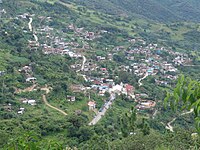 San Bartolomé Zoogocho
 -
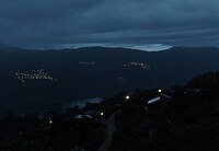 Frae left tae richt: Tanetze de Zaragoza, San Isidro Reforma, Juquila Vijanos Santo Domingo Cacalotepec


Municipalities
[eedit | eedit soorce]
The destrict includes the follaein municipalities:[2]
| Municipality | Aurie km2 | 2005 Population |
Indigenous leid speakers |
|---|---|---|---|
| San Andrés Solaga | 38 | 1,699 | |
| San Andrés Yaá | 37 | 378 | |
| San Baltazar Yatzachi el Bajo | 48 | 690 | |
| San Bartolomé Zoogocho | 23 | 381 | |
| San Cristóbal Lachirioag | 24 | 1130 | |
| San Francisco Cajonos | 26 | 371 | |
| San Ildefonso Villa Alta | 137 | 3,100 | |
| San Juan Juquila Vijanos | 37 | 1,908 | |
| San Juan Tabaá | 27 | 1,091 | |
| San Juan Yaeé | 93 | 1,344 | |
| San Juan Yatzona | 38 | 561 | |
| San Mateo Cajonos | 26 | 574 | |
| San Melchor Betaza | 37 | 919 | |
| San Pablo Yaganiza | |||
| San Pedro Cajonos | |||
| Santa María Temaxcalapa | |||
| Santa María Yalina | |||
| Santiago Camotlán | 333 | 3,089 | 2,461 |
| Santiago Lalopa | |||
| Santiago Zoochila | |||
| Santo Domingo Roayaga | |||
| Santo Domingo Xagacía | |||
| Tanetze de Zaragoza | 59 | 1,581 o | 1,327 |
| Villa Hidalgo | |||
| Villa Talea de Castro |
References
[eedit | eedit soorce]- ↑ "Distrito 13 Villa Alta" (PDF). oeidrus. Archived frae the original (PDF) on 22 Julie 2011. Retrieved 22 August 2010.
- ↑ "Enciclopedia de los Municipios de México: Estado de Oaxaca". Archived frae the original on 10 Januar 2013. Retrieved 8 Julie 2010.