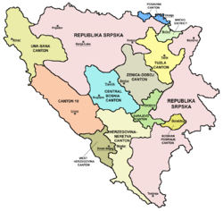
Una-Sana Canton
Una-Sana Canton
Unsko-sanski kanton[1] | |
|---|---|
 Location o the Una-Sana Canton | |
| Coordinates: 44°44′N 16°12′E / 44.733°N 16.200°E | |
| Kintra | Bosnie an Herzegovinae |
| Entity | Federation o Bosnie an Herzegovinae |
| Main ceety | Bihać |
| Municipalities | Bihać, Bosanska Krupa, Bosanski Petrovac, Bužim, Cazin, Ključ, Sanski Most, Velika Kladuša |
| Govrenment | |
| • Head of canton | Vacant |
| Area | |
| • Total | 4125.0 km2 (1,592.7 sq mi) |
| Population (2013 census) | |
| • Total | 299,343 |
| • Density | 72.56/km2 (187.9/sq mi) |
| ISO 3166 code | BA-01 |
| Website | http://www.vladausk.ba/ |

The Una-Sana Canton[1] (Bosnie: Unsko-sanski kanton[1]) is the first o the ten cantons o the Federation o Bosnie an Herzegovinae entity athin Bosnie an Herzegovinae. It is locatit in the northwast o the kintra an haes been namit efter the rivers Una an Sana. The centre o the cantonal govrenment is Bihać.
Municipalities
[eedit | eedit soorce]It is dividit intae municipalities (uisually eponymous wi touns) o Bihać, Bosanska Krupa, Bosanski Petrovac, Bužim, Cazin, Ključ, Sanski Most an Velika Kladuša.
Political subdivisions
[eedit | eedit soorce]| Municipality | Population | Area (km2) |
|---|---|---|
| Bihać | 61186 | 900 |
| Bosanska Krupa | 29659 | 561 |
| Bosanski Petrovac | 7946 | 709 |
| Bužim | 20298 | 129 |
| Cazin | 69411 | 356 |
| Ključ | 18714 | 358 |
| Sanki Most | 47359 | 781 |
| Velika Kladuša | 44770 | 331 |
Traffic
[eedit | eedit soorce]Due tae the proximity tae Croatia an that kintra's nairae northren outline, various important traffeck lines atween Zagreb an the Adriatic traverse the Una-Sana canton, sic as the railwey line Bosanski Novi — Bihać — Knin. The lairgest airport o Željava is locatit near Bihać an is locatit right atween Bosnian an Croatian border.
See an aw
[eedit | eedit soorce]References
[eedit | eedit soorce]- ↑ a b c The Constitution of the Una-Sana Canton Official name of canton is Una-Sana Canton
Coordinates: 44°44′N 16°12′E / 44.733°N 16.200°E
| Wikimedia Commons haes media relatit tae Una-Sana Canton. |


