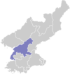
Kaechon
Kaech'ŏn Ceety | |
|---|---|
| Korean transcription(s) | |
| • Hangul | 개천시 |
| • Hanja | 价川市 |
| • Revised Romanisation | Gaecheon-si |
| • McCune–Reischauer | Kaech'ŏn-si |
| Short name transcription(s) | |
| • Hangul | 개천 |
| • Hanja | 价川 |
| • Revised Romanisation | Gaecheon |
| • McCune–Reischauer | Kaech'ŏn |
| Kintra | North Korea |
| Region | Kwansŏ |
| Admeenistrative diveesions | 25 dong, 11 ri |
| Govrenment | |
| • Teep | unner Pyongannam-do |
| Area | |
| • Total | 738 km2 (285 sq mi) |
| Population (1991) | |
| • Total | 336,000 |
| • Density | 460/km2 (1,200/sq mi) |
Kaech'ŏn (Hangul: 개천시, Hanja: 价川市) is a ceety in Pyongannam-do, North Korea.
Geography
[eedit | eedit soorce]The Myohyangsan, Changansan, Ch'ŏnsŏngsan, an Ch'ŏngryongsan muntain ranges come thegither in Kaechon. The heichest peak is Paekt'apsan. The maist important rivers are the Ch'ŏngch'ŏn River an the Taedong River. The aurie o the ceety is 61% forestit.
Economy
[eedit | eedit soorce]Watter resources are abundant, an several reservoirs are locatit in Kaechon.
Agricultur haes been extensivley developit, includin livestock an fruit orchards. Machinin an metalwirkin are the dominant industries, minin haes become mair prominent.
Tourism
[eedit | eedit soorce]Tourist steids in Kaechon include Songam Cavern, Taeripsa Temple wi its 9-level stane pagoda, the fortresses o Changhamsŏng, T'osŏng, an Kosasansŏng, Namsa dolmen, an the group o dolments at Mukpangsan. Thare are Yŏnpung Lake an aw, which wis constructit in 1956, an Yongwŏn Cavern, which wis discovered in 1966 an is preservit as North Korea's Natural Monument No. 43.
Preeson Camps
[eedit | eedit soorce]There are twa muckle preeson camps in Kaechon, baith kent for vera hairsk conditions:
- Kaechon internment camp is a preeson labor colony aroond 20 km (12 mi) sootheast o the ceety center at the banks o Taedong River. Shin Dong-hyuk wis born in the camp, tortured thare, an feenally saw his mither an brither executit afore he escaped.[1]
- Kaechon concentration camp is a preeson biggin complex aroond 2.5 km (1.6 mi) east o the ceety center. Lee Soon-ok wis impreesoned for sax years in the camp an gave testimony afore the Unitit States Senate.[2]
See an aw
[eedit | eedit soorce]Notes
[eedit | eedit soorce]- ↑ Choe Sang-hun (9 Julie 2007). "Born and raised in a North Korean gulag". International Herald Tribune. Archived frae the original on 12 Julie 2007. Retrieved 17 November 2012.
- ↑ "United States Senate Hearings: Testimony of Ms. Soon Ok Lee, June 21, 2002". Archived frae the original on 22 September 2008. Retrieved 17 November 2012.
Coordinates: 39°41′55″N 125°54′22″E / 39.6986°N 125.9061°E

