Hamhung
Appearance
Hamhung 함흥 | |
|---|---|
| 함흥시 | |
| Korean transcription(s) | |
| • Chosŏn'gŭl | 함흥시 |
| • Hancha | 咸興市 |
| • McCune-Reischauer | Hamhŭng-si |
| • Revised Romanization | Hamheung-si |
 A view o Hamhung frae the Kim Il-sung Monument | |
| Coordinates: 39°55′N 127°32′E / 39.917°N 127.533°ECoordinates: 39°55′N 127°32′E / 39.917°N 127.533°E | |
| Kintra | |
| Region | Kwannam |
| Area | |
| • Total | 330 km2 (130 sq mi) |
| Population (2008) | |
| • Total | 768,551 |
| • Dialect | Hamgyŏng |
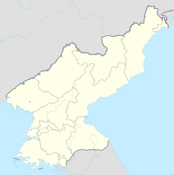
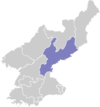
Hamhŭng (Hamhŭng-si; Korean pronunciation: [hamɣɯŋ-ɕi]) is North Korea's seicont lairgest ceety, an the caipital o Hamgyongnam-do. In late 2005, nearbi Hŭngnam wis made a ward (kuyŏk) athin Hamhŭng-si.[1] It haes a population o 768,551 as o 2008.[2]
Sister ceeties
[eedit | eedit soorce]References
[eedit | eedit soorce]- ↑ "행정구역 개편 일지". NKChosun (in Korean). Archived frae the original on 2 November 2006. Retrieved 29 Apryle 2006.CS1 maint: unrecognised leid (link)
- ↑ national census report.pdf United Nations Statistics Division; 2008 Census of Population of the Democratic People’s Republic of Korea conducted on 1–15 October 2008 (pdf-file)[deid airtin] Retrieved on 2009-03-18.
| Wikimedia Commons haes media relatit tae Hamhung. |
| This Asie-relatit airticle is a stub. Ye can help Wikipaedia bi expandin it. |
| This ceity-relatit airticle is a stub. Ye can help Wikipaedia bi expandin it. |


