Chagos Airchipelago
Appearance
| Disputit islands | |
|---|---|

| |
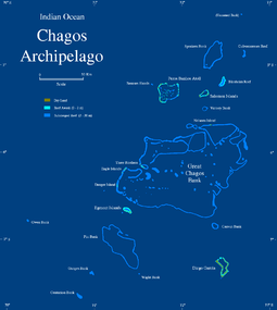
| Cairt o Location o the Chagos Airchipelago | |
| Geography | |
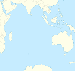
| Location of the Chagos Archipelago | |
| Location | Indian Ocean |
| Coordinates | 6°00′S 71°30′E / 6.000°S 71.500°ECoordinates: 6°00′S 71°30′E / 6.000°S 71.500°E |
| Major islands | Diego Garcia, Peros Banhos, Salomon Islands, Egmont Islands |
| 56.13 km2 | |
| Admeenistered bi | |
| {{kintra data Breetish Indian Ocean Territory (UK) |flag/core|name=Breetish Indian Ocean Territory (UK) |variant=|size=}} | |
| Caipital an lairgest settlement | Eclipse Pynt Toun (3,000) |
| Claimit bi | |
| Ooter islands | Chagos Archipelago |
| Demographics | |
| Population | 3,000 (as o 2014) |
| Ethnic groups | |
The Chagos Airchipelago (/ˈtʃɑːɡoʊs/ or /ˈtʃɑːɡəs/) or Chagos Islands (umwhile the Bassas de Chagas,[1] an later the Ile Islands) is a group o seiven atolls comprisin mair nor 60 individual tropical islands in the Indian Ocean aboot 500 kilometre (310 mi) sooth o the Maldives airchipelago.
References
[eedit | eedit soorce]- ↑ "Track of the Calcutta East Indiaman, over the Bassas de Chagas in the Indian Ocean". Catalogue.nla.gov.au. Retrieved 21 Juin 2012.

