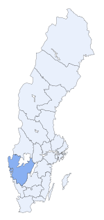
Västra Götaland Coonty
Västra Götaland Västra Götalands län | |
|---|---|
| Kintra | Swaden |
| Caipital | Gothenburg |
| Govrenment | |
| • Govrenor | Lars Bäckström |
| • Cooncil | Västra Götaland Regional Cooncil |
| Area | |
| • Total | 23945 km2 (9,245 sq mi) |
| Population (31 Mairch 2011)[1] | |
| • Total | 1,589,016 |
| • Density | 66/km2 (170/sq mi) |
| Time zone | UTC+1 (CET) |
| • Summer (DST) | UTC+2 (CEST) |
| GDP/ Nominal | SEK 386,538 million (2004) |
| GDP per capita | SEK 376,900 (2010) |
| NUTS Region | SE232 |
Västra Götaland Coonty (Swadish: Västra Götalands län) is a coonty or län on the wastren coast o Swaden.
The coonty is the seicont lairgest (in terms o population) o Swaden's coonties an it is subdividit intae 49 municipalities (kommuner). Its population o 1,550,000 amoonts tae 17% o Swaden's population. The caipital an govrenmental seat o Västra Götaland Coonty is Gothenburg.
The coonty wis established as recently as 1998, when Älvsborg Coonty, Gothenburg an Bohus Coonty an Skaraborg Coonty wur mergit.
Provinces
[eedit | eedit soorce]Sweden's coonties are generally o greater importance than its provinces. The coonties are the main admeenistrative units for politics, population coonts.
Due tae its size an young age, the Västra Götaland Coonty haes nae common inheritance. O cultural an historical significant are the provinces that Västra Götaland Coonty consists o: Västergötland, Bohuslän an Dalsland. There is an aw an insignificant pairt o the province Halland athin the coonty.
In addition, the previous coonties that wur abolished in 1999 haed been in uise syne the 17t century, an therefore hae some cultural an historical significance.
Neebours
[eedit | eedit soorce]Västra Götaland Coonty borders tae the coonties o Värmland, Örebro, Östergötland, Jönköping an Halland. It is an aw bundit bi the Norse coonty o Østfold, lakes Vättern an Vänern, as well as the strait o Skagerrak.
Admeenistration
[eedit | eedit soorce]Västra Götaland wis creatit in 1998 bi a merger o the three umwhile coonties o Gothenburg an Bohus Coonty, Älvsborg Coonty an Skaraborg County. The seat o residence for the Govrenors or Landshövding is Gothenburg, while the seat o poleetical admeenistration an pouer is Vänersborg. The Govrenor is the heid o the Coonty Admeenistrative Board or Länsstyrelse.
Politics
[eedit | eedit soorce]The Västra Götaland Regional Cooncil or Västra Götalandsregionen is an evolved Coonty Cooncil that for a trial period haes assumed certain tasks frae the Coonty Admeenistrative Board. Similar trial cooncils are appleed for Skåne Coonty an Gotland Coonty.
Municipalities
[eedit | eedit soorce]
Heraldry
[eedit | eedit soorce]The airms for the Coonty o Västra Götaland wis grantit in 1999 when the coonty was formed. It is a combination o the provincial airms o Västergötland, Bohuslän an Dalsland wi the airms for the ceety o Gothenburg. When the airms is shown wi a ryal croun it represents the Coonty Admeenistrative Board, which is the regional presence o (ryal) govrenment authority. Blazon: "Quartered, I. the airms o Gothenburg, II. the airms o Bohuslän, III. the airms o Dalsland turned in courtoisie, IV. the airms o Västergötland."
References an notes
[eedit | eedit soorce]Freemit airtins
[eedit | eedit soorce]- Leet o Västra Götaland Govrenors
- Region Västra Götaland
- Västra Götaland Coonty Admeenistrative Board
- Gothenburg Regional Association o Local Authorities Archived 2009-02-22 at the Wayback Machine
- Sjuhärad Regional Association o Local Authorities
- Skaraborg Regional Association o Local Authorities Archived 2002-11-22 at the Wayback Machine
- Fyrbodals Regional Association o Local Authorities Archived 2002-11-27 at the Wayback Machine
Coordinates: 58°13′01″N 11°44′00″E / 58.217025°N 11.733398°E


