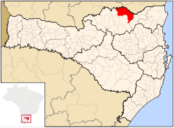
Mafra, Santa Catarina
Appearance
(Reguidit frae Mafra)
Mafra | |
|---|---|
Municipality | |
| The Municipality o Mafra | |
| Motto(s): Pérola do Planalto | |
 Location in the State o Santa Catarina | |
 | |
| Coordinates: 26°06′39″S 49°48′18″W / 26.11083°S 49.80500°W | |
| Kintra | |
| Region | Sooth |
| State | |
| Founded | September 8, 1917 |
| Govrenment | |
| • Mayor | João Alfredo Herbst (PMDB) |
| Area | |
| • Total | 1404.206 km2 (872.533 sq mi) |
| Elevation | 793 m (2601.7 ft) |
| Population (2007) | |
| • Total | 51,014 |
| • Density | 36.32/km2 (58.47/sq mi) |
| Time zone | UTC-3 (UTC-3) |
| • Summer (DST) | UTC-2 (UTC-2) |
| HDI (2000) | 0.788 |
| Website | www |
Mafra is a ceety locatit in the northren border o the state o Santa Catarina, Brazil. This ceety borders tae the state o Paraná an its urban aurie is attached tae the urban aurie o its interstate neebour, Rio Negro. This ceety's population is componit primarily o stryndants o European immigrants, especially frae Germany an Poland. This ceety is kent for its honey an aw, which is said tae hae excellent quality.


