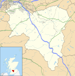
Larkhaw
Appearance
Larkhaw
| |
|---|---|
 Millheugh Bridge an the Larkhaw Viaduct | |
Location within Sooth Lanrikshire | |
| Population | 15,549 (2001) |
| OS grid reference | NS7651 |
| Ceevil pairish | |
| Cooncil area | |
| Lieutenancy area | |
| Kintra | Scotland |
| Sovereign state | Unitit Kinrick |
| Post toun | LARKHALL |
| Postcode destrict | ML9 |
| Diallin code | 01698 |
| Police | Scots |
| Fire | Scots |
| Ambulance | Scots |
| EU Pairlament | Scotland |
| UK Pairlament | |
| Scots Pairlament | |
Larkhaw[1] (Inglis: Larkhall, Scots Gaelic: Taigh na h-Uiseig)[2] is a toun in Sooth Lanrikshire, Scotland an is aroond 14 mile (23 km) sootheast o Glesga.
Etymology
[eedit | eedit soorce]The toun haes haed sindry names afore syne. Roy's Militar Map o the 1750s gies Laverockhall as the name o the toun[3], maist like giein mense tae the bird. Syne, maps gied the name as Larkhall[4], but baith Laverockhall and Larkhall war uised thegither for a fair while[5][6]. It's wirdy o tent that a hantle o gates athort Lanark are cried wi mense tae Laverockhall, for ensample in the toun o Lanark[7] an in Glesca[8].
References
[eedit | eedit soorce]- ↑ https://d3lmsxlb5aor5x.cloudfront.net/library/document/Map_of_Scotland_in_Scots-Guide_and_gazetteer.pdf
- ↑ "Ainmean-Àite na h-Alba ~ Gaelic Place-Names of Scotland". Archived frae the original on 25 Mey 2014. Retrieved 9 Mey 2014.
- ↑ "Explore georeferenced maps - Map images - National Library of Scotland". maps.nls.uk.
- ↑ "Explore georeferenced maps - Map images - National Library of Scotland". maps.nls.uk.
- ↑ "Caledonian Mercury (10th June 1802)". www.britishnewspaperarchive.co.uk. Retrieved 22 October 2020.
- ↑ "Scots Magazine (1st May 1793)". www.britishnewspaperarchive.co.uk. Retrieved 22 October 2020.
- ↑ "Laverockhall". Google Maps (in Inglis). Retrieved 22 October 2020.
- ↑ "Laverockhall St". Google Maps (in Inglis). Retrieved 22 October 2020.
| This Places o Scotland airticle is a stub. Ye can help Wikipaedia bi expandin it. |

