Hola Prystan
Hola Prystan (Гола Пристань) | |
|---|---|
Ceety | |
| Coordinates: 46°31′N 32°31′E / 46.517°N 32.517°E | |
| Kintra | |
| Oblast | Kherson Oblast |
| Area | |
| • Total | 9 km2 (3 sq mi) |
| Population (2007) | |
| • Total | 16,102 |
| Postal code | 75600 |
| Area code(s) | +380-5539 |
| Website | http://www.golapristan-mrada.gov.ua |
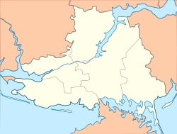
Hola Prystan (Ukrainian: Гола Пристань, Roushie: Голая Пристань) is a ceety in Kherson Oblast (province) o Ukraine. The Konka River (a tributar o the Dnieper River) flows throu the ceety.
History
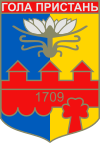
[eedit | eedit soorce]Hola Prystan (Roushie - "Golaya Pristan") wis foondit in 1709.
In the years o the Ukrainian Unthirldom
[eedit | eedit soorce]Due tae the support o Deputy Heid o the Regional policy admeenistration, heid o the sooth regions’ depairtment o the Main Depairtment on regional an human resources policy at the Presidential Admeenistration o Ukraine, O.M. Orel, heid o the Kherson state admeenistration Mykola Kostyak, heid o the Kherson region cooncil V.H. Pelykh, heid o the Hola Prystan’ aurie admeenistration A.A. Nosyk, heid o the Hola Prystan’ aurie cooncil H.V. Popov, a nummer o deputies o the Verkhovna Rada an Public deputies o Ukraine totallin 286 fowk (as tae the results o votin on the plenar session) Hola Pristan’ gained the regional toun status on 17 Mey 2013.


