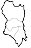
Dobong-gu
Appearance
Dobong-gu 도봉구 | |
|---|---|
| 도봉구 · 道峰區 | |
 Skyline o Dobong-gu (left side) | |
 Location o Dobong-gu in Seoul | |
| Kintra | Sooth Korea |
| Region | Sudogwon |
| Special Ceety | Seoul |
| Admeenistrative dong | 14 |
| Area | |
| • Total | 20.8 km2 (8.0 sq mi) |
| Population (2010[1]) | |
| • Total | 348,625 |
| • Density | 17,000/km2 (43,000/sq mi) |
| Time zone | UTC+9 (Korea Staundart Time) |
| Website | Dobong-gu offeecial wabsteid |
Dobong-gu is ane o the 25 destricts (gu) o Seoul, Sooth Korea. It is locatit on the north side o the Han River.
Symbols
[eedit | eedit soorce]- Flower : Climbin rose
- Tree : Pine tree'
- Bird : Pigeon
Muntain
[eedit | eedit soorce]Mt. Dobong is nearbi an actually its aurie is in chairge o dobong-gu. Dobongsan, which provides a restin place tae Dobong-gu residents, is locatit in the northeast o Mt. Bukhan.
In addeetion, Mt Dobong haes mony lairge an smaw temples sic as Cheonchuksa, Wontongsa, an Manweolam.[2]
Admeenistrative diveesions
[eedit | eedit soorce]
Dobong-gu is componit o fower dong.
- Dobong-dong (도봉동 道峰洞) 1, 2
- Banghak-dong (방학동 放鶴洞) 1, 2, 3
- Ssangmun-dong (쌍문동 雙門洞) 1, 2, 3, 4
- Chang-dong (창동 倉洞) 1, 2, 3, 4, 5
Transportation
[eedit | eedit soorce]Railroad
[eedit | eedit soorce]- (Nowon-gu) ← Chang-dong — Ssangmun → (Gangbuk-gu)
Sister ceeties
[eedit | eedit soorce]References
[eedit | eedit soorce]- ↑ Korean Statistical Information Service (Korean) > Population and Household > Census Result (2010) > Population by Administrative district, Sex and Age / Alien by Administrative district and Sex, Retrieved 2010-06-02.
- ↑ English Dobong-gu[deid airtin]
Freemit airtins
[eedit | eedit soorce]| Wikimedia Commons haes media relatit tae Dobong-gu, Seoul. |
Korean
[eedit | eedit soorce]Coordinates: 37°41′42″N 127°02′49″E / 37.69500°N 127.04694°E

