Tikal
Appearance
 Tikal Temple I rises 47 metre (154 ft) heich.[1] | |
| Alternate name | Yax Mutal |
|---|---|
| Location | Flores, Petén Depairtment, Guatemala |
| Region | Petén Basin |
| Coordinates | 17°13′19.54″N 89°37′25.01″W / 17.2220944°N 89.6236139°W |
| History | |
| Periods | Early Clessic tae Late Clessic |
| Culturs | Maya ceevilisation |
| Offeecial name | Tikal Naitional Pairk |
| Teep | Mixed |
| Criteria | i, iii, iv, ix, x |
| Designatit | 1979 (3rd session) |
| Reference no. | 64 |
| State Pairty | Guatemala |
| Region | Laitin Americae an the Caribbean |
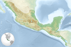
Tikal (/tiˈkäl/) (Tik’al in modren Mayan orthografie) is the ruin o an auncient ceety, which wis likely tae hae been cried Yax Mutal, foond in a rainforest in Guatemala.[2]
References
[eedit | eedit soorce]- ↑ Martin & Grube 2000, p.47.
- ↑ "Tikal Information". CyArk. Archived frae the original on 30 September 2008. Retrieved 19 December 2014.
Coordinates: 17°13′19.54″N 89°37′25.01″W / 17.2220944°N 89.6236139°W
Categeries:
- Tikal
- Maya steids in Petén Depairtment
- Maya Clessic Period
- Naitional pairks o Guatemala
- Warld Heritage Steids in Guatemala
- Airchaeological steids in Guatemala
- Umwhile populatit places in Guatemala
- Populatit places established in the 4t century BC
- 4t-century BC establishments in Guatemala
- 4t-century BC establishments in the Maya ceevilisation


