Rocca Sinibalda
Appearance
Rocca Sinibalda | |
|---|---|
| Comune di Rocca Sinibalda | |
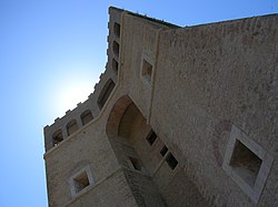
 The Sforza Cesarini Castle. | |
| Coordinates: 42°16′N 12°56′E / 42.267°N 12.933°ECoordinates: 42°16′N 12°56′E / 42.267°N 12.933°E | |
| Kintra | Italy |
| Region | Lazio |
| Province | Rieti (RI) |
| Frazioni | Magnalardo, Pantana, Posticciola, Tomassella, Torricchia, Trampani, Vallecupola |
| Govrenment | |
| • Mayor | Giancarlo Marotti |
| Area | |
| • Total | 49.4 km2 (19.1 sq mi) |
| Elevation | 552 m (1,811 ft) |
| Population (2008)[1] | |
| • Total | 836 |
| • Density | 17/km2 (44/sq mi) |
| Demonym(s) | Roccheciani |
| Time zone | UTC+1 (CET) |
| • Summer (DST) | UTC+2 (CEST) |
| Postal code | 02026 |
| Diallin code | 0765 |
Rocca Sinibalda is a comune (municipality) in the Province o Rieti in the Italian region Lazio, locatit aboot 50 kilometre (31 mi) northeast o Roum an aboot 15 kilometre (9 mi) sootheast o Rieti.
It is hame tae the Sforza Cesarini Castle, oreeginally biggit in 1084 but turned intae a mair modren fortress in the 1530s bi Baldassare Peruzzi, commissioned bi Cardinal Alessandro Cesarini. The interior haes frescoes frae the 17t an 18t hunderyears.
The remains o the auncient Sabine toun o Trebula Mutusca are no far.

