La Ferté-Gaucher
Appearance
La Ferté-Gaucher | |
|---|---|
 Chapel o the Knichts Templar | |
| Coordinates: 48°47′03″N 3°18′29″E / 48.7842°N 3.308°ECoordinates: 48°47′03″N 3°18′29″E / 48.7842°N 3.308°E | |
| Kintra | Fraunce |
| Region | Île-de-France |
| Depairtment | Seine-et-Marne |
| Arrondissement | Provins |
| Canton | La Ferté-Gaucher |
| Govrenment | |
| • Mayor (2008–2014) | Yves Jaunaux |
| Area 1 | 17.32 km2 (6.69 sq mi) |
| Population (2006)2 | 4,102 |
| • Density | 240/km2 (610/sq mi) |
| Time zone | UTC+1 (CET) |
| • Summer (DST) | UTC+2 (CEST) |
| INSEE/Postal code | 77182 /77320 |
| Elevation | 107–188 m (351–617 ft) |
| 1 French Laund Register data, that excludes lochs, ponds, glaciers > 1 km² (0.386 sq mi or 247 acres) an river estuaries. 2 Population withoot dooble coontin: residents o multiple communes (e.g., students an militar personnel) anerly coontit ance. | |
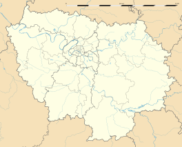
La Ferté-Gaucher is a commune in the Seine-et-Marne depairtment in the Île-de-France region in north-central Fraunce.
Demographics
[eedit | eedit soorce]Indwallers o La Ferté-Gaucher are ried Fertois.
See an aw
[eedit | eedit soorce]References
[eedit | eedit soorce]Freemit airtins
[eedit | eedit soorce]| Wikimedia Commons haes media relatit tae La Ferté-Gaucher. |
- 1999 Land Use, from IAURIF (Institute for Urban Planning and Development of the Paris-Île-de-France région) Archived 2007-09-29 at the Wayback Machine (in Inglis)
- French Ministry of Culture list for La Ferté-Gaucher (in French)
- Map of La Ferté-Gaucher on Michelin Archived 2013-01-14 at Archive.today (in Inglis)


