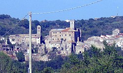
Faleria
Appearance
Faleria | |
|---|---|
| Comune di Faleria | |
 | |
| Coordinates: 42°13′N 12°26′E / 42.217°N 12.433°ECoordinates: 42°13′N 12°26′E / 42.217°N 12.433°E | |
| Kintra | Italy |
| Region | Lazio |
| Province | Province o Viterbo (VT) |
| Area | |
| • Total | 25.7 km2 (9.9 sq mi) |
| Elevation | 202 m (663 ft) |
| Population (Dec. 2004) | |
| • Total | 2,136 |
| • Density | 83/km2 (220/sq mi) |
| Time zone | UTC+1 (CET) |
| • Summer (DST) | UTC+2 (CEST) |
| Postal code | 01030 |
| Diallin code | 0761 |
| Website | Offeecial wabsteid |
Faleria is a comune (municipality) in the Province o Viterbo in the Italian region Latium, locatit aboot 35 kilometre (22 mi) north o Roum an aboot 35 kilometre (22 mi) sootheast o Viterbo. As o 31 Dizember 2004, it haed a population o 2,136 an a aurie o 25.7 square kilometre (9.9 sq mi).[1]
Faleria borders the follaein municipalities: Calcata, Castel Sant'Elia, Civita Castellana, Mazzano Romano, Rignano Flaminio, Sant'Oreste.
Demographic evolution
[eedit | eedit soorce]

