Dornie
Dornie
| |
|---|---|
 | |
Location within the Hieland cooncil aurie | |
| Population | 360 |
| OS grid reference | NG881261 |
| Cooncil area | |
| Kintra | Scotland |
| Sovereign state | Unitit Kinrick |
| Post toun | Dornie |
| Postcode destrict | IV40 8 |
| Police | Scots |
| Fire | Scots |
| Ambulance | Scots |
| EU Pairlament | Scotland |
| UK Pairlament | |
| Scots Pairlament | |
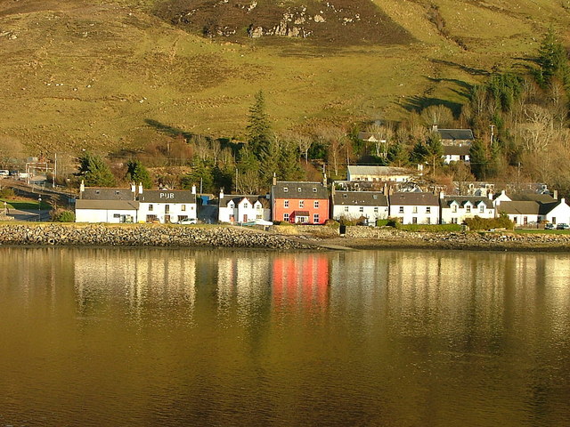
Dornie (Scots Gaelic: An Dòrnaidh )[1] is a smaw umwhile fishin veelage in the Kintail destrict in wastren Ross-shire Hielands o Scotland, wi a population o 360 (2006 census [1]). It is near the meetin point o Loch Duich, Loch Alsh an Loch Long.
The A87, the main road tae Skye, passes juist ootside the veelage. Afore the construction o the brig, the main road passed throu the centre o the veelage an crossed Loch Long via a short ferry ride. Amongst bagpipers, the tune Dornie Ferry is weel kent strathspey.
Eilean Donan is a famous castle on a nearbi island. The veelage itsel runs alangside the watter hostin a variety o veelage hames, ane tiny shop, a hotel an twa bars. Dornie is the main stay o Kinlochshiel Shinty Club an aw.
St Duthac's Catholic Church dates fae 1860 an wis designt bi architect Joseph A Hansom. It's in the Gothic style wi a stane reredos o polisht granite shafts an a demi-octagonal stane pulpit, an unusual feature in a Scots church.[2]
References
[eedit | eedit soorce]| This Places o Scotland airticle is a stub. Ye can help Wikipaedia bi expandin it. |

