Auld Dongola
Old Dongola (Old Nubian: Tungul; Arabic: Dunqulah al-ʿAjūz) is a toun in Sudan, on the east bank o the Nile opposite the Wadi Al-Malik. It is 50 mile (80 km) upstream frae (New) Dongola. Old Dongola wis the departure pynt for caravans wast tae Darfur an Kordofan.

It wis an important ceety in Mediaeval Nubia. Frae the fowert tae the fowerteent century it wis the caipital o the Makurian state. In the Fift Century Old Dongola wis foondit as fortress, but became suin a toun. Latest wi the arrival o Christianity it became the caipital. Several kirks war biggit. Thare wis the Building X an the Church with the Stone Pavement. Thare war erected aboot 100 m apart frae the walled toun centre, indicating that at this time the toun already extendit ower the oreeginal walls o the fortress. In the middile o the Seivent century, the toun wis attacked bi the Arabs, but wis nae conquered. Houiver, the twa main kirks war destroyed, but shortly efter rebuild. Building material o the Old Church wis uised for supporting the ceety walls.

The Building X wis suin replaced bi the Old Church.
The Church of the Granite Columns wis erected at the end o the Seivent Century ower the Old Church. It wis aiblins the cathedral o Old Dongola an adorned wi 16 granite columns. Thir columns haed richly decorated granite capitals.

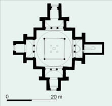
Aroond the Tenth century, Old Dongola haed its heyday. At the place o the Church of the Stone Pavements, the Cruciform Church wis erected. At this time Old Dongola haed mony ither kirks, at least twa pailaces, an in the North a huge monastery. Several houses war well equipped an haed bath rooms an wall pentins.
In the thirteent an fowerteent Century, the toun lost importance. It wis attackt bi Arabs several times an the throne room o the palace wis convertit tae a mosque.
Unner the Funj, Auld Dongola wis the caipital o the Northren provinces.
When the traveller C.J. Poncet travelled throu the ceety, he describit it as locatit on the slope o a sandy hill. His description o Auld Dongola continues:
- The hooses are ill built, an the streets hauf desertit an fill'd wi heaps o saund, occasion'd bi floods frae the mountains. The castle is in the vera center o the toun. It is lairge an spacious, but the fortifications are inconsiderable. It keeps in awe the Arabians, who are masters o the open kintra.[1]
A Pols archaeological team haes been excavatin the toun syne 1964.
Notes
[eedit | eedit soorce]- ↑ Charles Jacques Poncet in The Red Sea and Adjacent Countries, William Foster, editor (London: Hakluyt Society, 1949), pp. 99f.
Coordinates: 18°13′N 30°45′E / 18.217°N 30.750°E
| Wikimedia Commons haes media relatit tae Old Dongola. |
