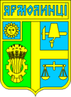
Yarmolyntsi
Appearance
Yarmolyntsi Ярмолинці | |
|---|---|
| Coordinates: 49°11′33″N 26°50′23″E / 49.19250°N 26.83972°ECoordinates: 49°11′33″N 26°50′23″E / 49.19250°N 26.83972°E | |
| Kintra | |
| Province | Khmelnytskyi Oblast |
| Destrict | Yarmolyntsi Raion |
| Foondit | 1400 |
| Toun status | 1958 |
| Govrenment | |
| • Toun Heid | Vasyl Atamanchuk[1] |
| Area | |
| • Total | 4.46 km2 (1.72 sq mi) |
| Elevation | 341 m (1,119 ft) |
| Population (2012) | |
| • Total | |
| Time zone | UTC+2 (EET) |
| • Summer (DST) | UTC+3 (EEST) |
| Postal code | 32100 |
| Aurie code | +380 3853 |
| Website | http://rada.gov.ua/ |
Yarmolyntsi (Ukrainian: Ярмолинці) is an urban-teep dounset in the Khmelnytskyi Oblast in wastren Ukraine.[1] It serves as the admeenistrative center o the Yarmolyntsi Raion (destrict), hoosin the destrict's local admeenistration biggins. The toun's population wis 8,806 as o the 2001 Ukrainian Census[1] an 7,954 in 2011.[3]
The dounset wis first foondit in 1400. It receivit the Magdeburg richts in 1455. Yarmolyntsi haes haed the status o a urban-teep dounset syne 1958.[1]
References
[eedit | eedit soorce]- ↑ a b c d "Yarmolyntsi, Khmelnytskyi Oblast, Yarmolyntsi Raion". Regions of Ukraine and their Structure (in Ukrainian). Verkhovna Rada of Ukraine. Retrieved 12 Mairch 2013.
- ↑ "Yarmolyntsi (Khmelnytskyi Oblast, Yarmolyntsi Raion)". weather.in.ua (in English). Retrieved 12 Mairch 2013.CS1 maint: unrecognised leid (link)
- ↑ "Actual Population of Ukraine on January 1, 2011". State Statistics Committee of Ukraine (in Ukrainian). Main Statistical Office in L'viv region. Archived frae the original (PDF) on 2012-10-10. Retrieved 12 March. Check date values in:
|accessdate=(help)

