
Talca
Talca | |
|---|---|
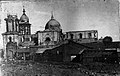
 Dountoun as seen frae Cerro La Virgen. | |
 Coat airms  Location o Talca commune in Maule Region  Talca Location in Chile | |
| Coordinates: 35°26′0″S 71°40′0″W / 35.43333°S 71.66667°W | |
| Region | Maule Region |
| Province | Talca Province |
| Foondit | 12 Mey 1742 |
| Govrenment | |
| • Teep | Municipality |
| • Alcalde | Juan Castro Prieto (Independent Democratic Union) |
| Area | |
| • Total | 231.5 km2 (89.4 sq mi) |
| Elevation | 102 m (335 ft) |
| Population (2002 Census)[3] | |
| • Total | 201,797 |
| • Density | 870/km2 (2,300/sq mi) |
| • Urban | 193755 |
| • Landwart | 8042 |
| Sex | |
| • Men | 96,810 |
| • Weemen | 104,987 |
| Time zone | UTC−4 (CLT) |
| • Summer (DST) | UTC−3 (CLST) |
| Postal code | 3460000 |
| Area code(s) | 56 (kintra) + 71 (Talca Province) |
| Website | Offeecial wabsteid (in Spaingie) |
Talca is a ceety an commune in Chile locatit aboot 255 km (158 mi) sooth o Santiago, an is the caipital o baith Talca Province an Maule Region (7t Region o Chile). As o the 2002 census, the ceety haed a population o 193,755.
The ceety is an important economic centre, wi agricultural (wheat) an manufacturin activities, as well as wine production. It is the location o the Universidad de Talca an the Catholic Varsity o Maule an aw, amang ithers. The Catholic Kirk o Talca haes held a prominent role in the history o Chile.
The inhabitants o Talca hae a sayin, Talca, Paris & Lunnon, born frae a hat shop which haed placit a ribbon statin that it haed branches in Paris an Lunnon. The shop wis awned bi a French immigrant namit Jean-Pierre Lagarde.
Demographics
[eedit | eedit soorce]Accordin tae the 2002 census o the Naitional Statistics Institute, Talca spans a aurie o 231.5 km2 (89 sq mi) an haes 201,797 inhabitants (96,810 men an 104,987 weemen). O these, 193,755 (96%) livit in urban auries an 8,042 (4%) in landwart auriess. The population grew bi 17.8% (30,510 bodies) atween the 1992 an 2002 censuses.[3]
History
[eedit | eedit soorce]The ceety wis foondit in 1692 bi Tomás Marín de Poveda an refoondit as Villa San Agustín de Talca in 1742 bi José Antonio Manso de Velasco.[4] It wis pairtially destroyed bi the 1928 Talca yirdquauk an the 2010 Chile yirdquauk, bein rebuilt baith times. It sits near the epicentre o the 2010, yirdquauk 8.8 yirdquauk an suffered severe shakin[5] causin the collapse o hintle o the historic toun centre.[6] The ceety played a role in Chile's unthirldom. Here, Bernardo O'Higgins signed the Chilean independence declaration in 1818.[4]
Administration
[eedit | eedit soorce]
As a commune, Talca is a third-level admeenistrative diveesion o Chile admeenistered bi a municipal cooncil, heidit bi an alcalde who is directly electit ivery fower years. The 2008-2012 alcalde is Juan Castro Prieto (Independent Democratic Union, centre-richt).[1][2]
Athin the electoral diveesions o Chile, Talca is representit in the Chamber o Deputies bi Sergio Aguiló (PS) an Germán Verdugo (RN) as pairt o the 37t electoral destrict, which consists entirely o the Talca commune. The commune is representit in the Senate bi Juan Antonio Coloma Correa (UDI) an Andrés Zaldívar Larraín (PDC) as pairt o the 10t senatorial constituency (Maule-North).
Geografie o climate
[eedit | eedit soorce]The commune o Talca spans a aurie o 231.5 km2 (89 sq mi).[3] The ceety o Talca is locatit 250 km (155 mi) sooth o Santiago,[4] sooth o the confluence o the rivers Lircay an Claro, in the Central Valley. The ceety is bisectit bi the Pan-American Heich-gate.
Talca haes a Mediterranean climate wi dry simmers an wet winters, tho it is hotter in simmer an ceuler in winter than coastal ceeties like Valparaíso an Concepcíon.
| Climate data for Talca | |||||||||||||
|---|---|---|---|---|---|---|---|---|---|---|---|---|---|
| Month | Jan | Feb | Mar | Apr | May | Jun | Jul | Aug | Sep | Oct | Nov | Dec | Year |
| Average heich °C (°F) | 31.3 (88.3) |
30.7 (87.3) |
27.1 (80.8) |
22.1 (71.8) |
17.5 (63.5) |
12.9 (55.2) |
13.5 (56.3) |
15.1 (59.2) |
18.3 (64.9) |
22.1 (71.8) |
24.6 (76.3) |
29.2 (84.6) |
22.0 (71.6) |
| Daily mean °C (°F) | 22.0 (71.6) |
19.8 (67.6) |
18.2 (64.8) |
14.1 (57.4) |
10.8 (51.4) |
8.7 (47.7) |
8.2 (46.8) |
9.5 (49.1) |
11.6 (52.9) |
14.6 (58.3) |
17.4 (63.3) |
20.5 (68.9) |
14.6 (58.3) |
| Average law °C (°F) | 13.1 (55.6) |
12.0 (53.6) |
10.4 (50.7) |
7.9 (46.2) |
6.6 (43.9) |
5.8 (42.4) |
4.4 (39.9) |
4.2 (39.6) |
6.6 (43.9) |
8.5 (47.3) |
10.9 (51.6) |
13.1 (55.6) |
8.6 (47.5) |
| Average rainfaw mm (inches) | 7.2 (0.28) |
4.4 (0.17) |
13.8 (0.54) |
36.4 (1.43) |
123.0 (4.84) |
160.8 (6.33) |
137.6 (5.42) |
92.8 (3.65) |
55.0 (2.17) |
31.1 (1.22) |
15.8 (0.62) |
11.4 (0.45) |
689.3 (27.12) |
| Source: Información climatológica de estaciones chilenas: Chile Centro[7] | |||||||||||||
Gallery
[eedit | eedit soorce]-
 A garden pavilion in Plaza de Armas (Armas Square)
 -
 O'Higginian Historical Museum (Museo Historico O'higginiano)
 -
 Calle Sur de Talca (Talca Southern Street}
 -
 Eftermath in damage at Talca Cathedral, bi 1928 Talca yirdquauk


See an aw
[eedit | eedit soorce]References
[eedit | eedit soorce]- ↑ a b (in Spaingie) "Municipality of Talca". Retrieved 22 Januar 2010.
- ↑ a b (in Spaingie) "Asociación Chilena de Municipalidades". Retrieved 22 Januar 2011. Cite error: Invalid
<ref>tag; name "Munitel" defined multiple times wi different content - ↑ a b c d e (in Spaingie) "National Statistics Institute". Archived frae the original on 6 Januar 2019. Retrieved 28 Julie 2010.
- ↑ a b c "Maule Region". Universidad de Talca. Archived frae the original on 14 Mairch 2008. Retrieved 30 Julie 2008.
- ↑ Intensity of shaking in cities around the 2010 Chilean earthquake from USGS
- ↑ Images of earthquake including collapse of Talca historic centre
- ↑ "Datos climatológicos Chile Centro". Atmosfera.cl. 30 Mey 2012. Archived frae the original on 13 Juin 2013. Retrieved 14 December 2013.
Freemit airtins
[eedit | eedit soorce]| Wikimedia Commons haes media relatit tae Talca. |
- (in Spaingie) Municipality o Talca
- Urban Umbrella Architectural Exhibition Archived 2009-10-21 at the Wayback Machine
- Talca's Gate Archived 2007-01-15 at the Wayback Machine
- El aMaule
- La Prensa Archived 2008-01-18 at the Wayback Machine
- El Centro Archived 2021-02-10 at the Wayback Machine
- WWW.DELMAULE.CL
