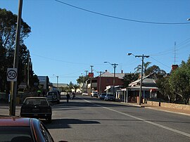
Northampton, Wastren Australie
Appearance
| Northampton Wastren Australie | |||||||||
|---|---|---|---|---|---|---|---|---|---|
 Hampton Street | |||||||||
| Coordinates | 28°21′04″S 114°37′41″E / 28.35111°S 114.62806°ECoordinates: 28°21′04″S 114°37′41″E / 28.35111°S 114.62806°E | ||||||||
| Population | 830 (2021 census)[1] | ||||||||
| Established | 1864 | ||||||||
| Postcode(s) | 6535 | ||||||||
| Location | |||||||||
| LGA(s) | Shire of Northampton | ||||||||
| State electorate(s) | Moore | ||||||||
| Federal Diveesion(s) | Durack | ||||||||
| |||||||||
Northampton is a toun locatit in the Mid West region o Wastren Australie. At the 2011 census, the toun haed a population o 868.[2] The toun contains a National Trust biggin. The toun lees on the North West Coastal Highway. Oreeginally cried The Mines, Northampton wis gazettit in 1864 an namit efter the colony's Govrenor, John Hampton. The toun wis steidit in the Nokanena Brook valley, atween the hamlets aroond the twa major copper mines in the aurie, the Wanerenooka an the Gwalla.[3]
It is the service toun tae the micronaition, the Principality o Hutt River.
References
[eedit | eedit soorce]- ↑ Australian Bureau of Statistics (28 Juin 2022). "Northampton (State Suburb)". 2021 Census QuickStats. Retrieved 7 Mey 2023.

- ↑ Australian Bureau of Statistics. "Northampton (L)". 2011 census QuickStats. Archived frae the original on 24 September 2015. Retrieved 21 October 2013.
- ↑ Wright, Judy (2006). Selling Sparrows. Dunstable, Bedfordshire: J.H. Wright & The Book Castle. p. 389. ISBN 978-0955351600.

