Kigali
Appearance
(Reguidit frae Kigali Province)
Kigali | |
|---|---|
 Kigali, Rwanda | |
| Coordinates: 1°56′38″S 30°3′34″E / 1.94389°S 30.05944°ECoordinates: 1°56′38″S 30°3′34″E / 1.94389°S 30.05944°E | |
| Kintra | Rwanda |
| Province | Kigali Ceety |
| Founded | 1907 |
| Govrenment | |
| • Mayor | Pascal Nyamulinda (FPR) |
| Area | |
| • Total | 730 km2 (280 sq mi) |
| Elevation | 1567 m (5,141 ft) |
| Population (2015 census) | |
| • Total | 1,132,686 |
| • Density | 1,600/km2 (4,000/sq mi) |
| Time zone | UTC+2 (CAT) |
| • Summer (DST) | UTC+2 (none) |
| Destricts 1. Gasabo 2. Kicukiro 3. Nyarugenge |  |
| Website | www |
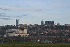
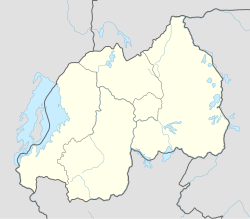
Kigali is the caipital an lairgest ceety o Rwanda. It is situatit near the geographic centre o the naition, an haes been the economic, cultural, an transport hub o Rwanda syne it became caipital at unthirldom in 1962. The main residence an offices o the Preses o Rwanda are locatit in the ceety, as are the govrenment meenistries. The ceety is coterminous wi the province o Kigali Ceety, which wis enlairged in Januar 2006 as pairt o local govrenment reorganisation in the kintra. The ceety's urban aurie covers aboot 70% o the municipal bundaries.[1]
References
[eedit | eedit soorce]- ↑ "Kigali at a Glace" Archived 2014-02-28 at the Wayback Machine, Official Website of Kigali City, accessed 15 August 2008
| Wikimedia Commons haes media relatit tae Kigali. |

