Kamianets-Podilskyi
Kamyanets-Podilsky Кам’янець-Подільський | |
|---|---|
 View owerleuking the ceety's castle. | |
| Coordinates: 48°41′00″N 26°35′00″E / 48.68333°N 26.58333°E | |
| Country | |
| Oblast | |
| Raion | Kamyanets-Podilskyi Raion |
| Foondit | 1062 (first mentioned) |
| Ceety richts | 1795 |
| Govrenment | |
| • Mayor | Mikhaylo Simashkevich |
| Area | |
| • Total | 27871 km2 (10,761 sq mi) |
| Population (2024) | |
| • Total | |
| • Density | 3550/km2 (9,200/sq mi) |
| Time zone | UTC+2 (EET) |
| • Summer (DST) | UTC+3 (EEST) |
| Postal code | 32300—32318 |
| Area code(s) | +380-3849 |
| Sister ceeties | Targówek, Kraków, Głogów, Przemyśl, Kalisz, Sanok, Gniew, Zawiercie, Ejmiatsin, Suzhou, Ukmergė, Polatsk, Edineţ, Zalău, Dolný Kubín, Ponte Lambro, Michurinsk |
Kamyanets-Podilsky (Ukrainian: Кам’янець-Подільський, translit. Kam’ianets’-Podil’s’kyi or Kamyanets-Podilsky, Armenie: Կամիանեց-Պոդոլսկի, Pols: Kamieniec Podolski, Romanian Camenița, Roushie: Каменец-Подольский, translit. Kamenets-Podolskiy) is a ceety on the Smotrych River in wastren Ukraine, tae the north-east o Chernivtsi.
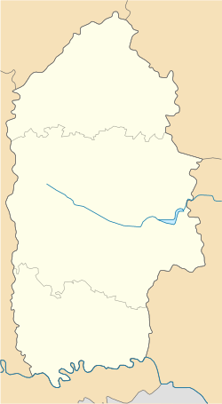
Umwhile the admeenistrative center o the Khmelnytskyi Oblast, the ceety is nou the admeenistrative centre o the Kamianets-Podilskyi Raion (destrict) within the Khmelnytskyi Oblast (province), efter the admeenistrative centre o the oblast wis moved frae the ceety o Kamyanets-Podilsky tae the ceety o Khmelnytskyi in 1941. The ceety itself is an aa designatit as a separate destrict within the region.
The current estimatit population is aroond 110,000 (2024[1]).
- ↑ "Вікенд в Кам'янець-Подільську: що подивитися та де смачно поїсти". www.unian.ua (in Ukrainian). Retrieved 30 December 2024.


