Carthage, Missouri
Carthage, Missouri | |
|---|---|
 Stores aroond th Coorthoose square | |
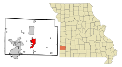
 Location athin Jasper Coonty an Missouri | |
| Coordinates: 37°10′4″N 94°18′54″W / 37.16778°N 94.31500°WCoordinates: 37°10′4″N 94°18′54″W / 37.16778°N 94.31500°W | |
| Kintra | Unitit States |
| State | Missouri |
| Coonty | Jasper |
| Govrenment | |
| • Teep | Ceety Cooncil |
| • Mayor | Mike Harris |
| Area | |
| • Total | 30.28 km2 (11.69 sq mi) |
| • Laund | 30.17 km2 (11.65 sq mi) |
| • Water | 0.10 km2 (0.04 sq mi) |
| Elevation | 306 m (1004 ft) |
| Population | |
| • Total | 14,378 |
| • Estimate (2012[3]) | 14,097 |
| • Density | 470/km2 (1,200/sq mi) |
| Time zone | UTC-6 (Central (CST)) |
| • Summer (DST) | UTC-5 (CDT) |
| ZIP code | 64836 |
| Area code(s) | 417 |
| FIPS code | 29-11656 [4] |
| GNIS featur ID | 0715455 [5] |
Carthage is a ceety in the U.S. state o Missouri. The population wis 14,378 at the 2010 census. It is the coonty seat o Jasper Coonty.[6] It is elknamit "America's Maple Leaf Ceety."[7]
References[eedit | eedit soorce]
- ↑ "US Gazetteer files 2010". United States Census Bureau. Archived frae the original on 14 Julie 2012. Retrieved 8 Julie 2012. Unknown parameter
|deadurl=ignored (help) - ↑ "American FactFinder". United States Census Bureau. Retrieved 8 Julie 2012.
- ↑ "Population Estimates". United States Census Bureau. Retrieved 30 Mey 2013.
- ↑ "American FactFinder". United States Census Bureau. Retrieved 31 Januar 2008.
- ↑ "US Board on Geographic Names". United States Geological Survey. 25 October 2007. Retrieved 31 Januar 2008.
- ↑ "Find a County". National Association of Counties. Retrieved 7 Juin 2011.
- ↑ Carthage, Missouri Chamber of Commerce - America's Maple Leaf City!
