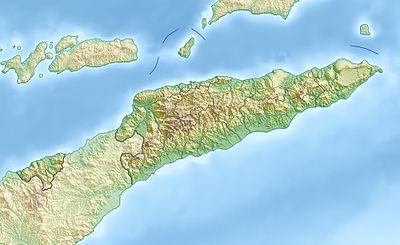
Template:Location map East Timor
Appearance
| name | East Timor | |||
|---|---|---|---|---|
| border coordinates | ||||
| -7.8 | ||||
| 123.9 | ←↕→ | 127.5 | ||
| -10.0 | ||||
| map center | 8°54′S 125°42′E / 8.9°S 125.7°E | |||
| image | East Timor adm-2 location map.svg
| |||

| ||||
| image1 | East Timor relief location map.jpg
| |||

| ||||
How to use an alternative map
[eedit soorce]This template normally displays the map shown above as image:
- East Timor adm-2 location map.svg.
The AlternativeMap parameter in Template:Location map can be used to display the following image:
- East Timor relief location map.jpg
Further instructions and examples can be found at Template:Location map#Using Alternative Map.
