Saraburi Province

Saraburi (Thai: สระบุรี) is ane o the central provinces (changwat) of Thailand. Neighborin provinces are (frae north clockwise) Lopburi, Nakhon Ratchasima, Nakhon Nayok, Pathum Thani an Ayutthaya. Saraburi haes been an important toun syne auncient times. It is believed tae hae been constructit in the year 1548 durin the reign o Keeng Maha Chakkraphat o Ayutthaya as a centre for recruitin troops.
Geography
[eedit | eedit soorce]Saraburi is locatit on the east side o the Chao Phraya river valley. The east pairt o the province is covered bi heich plains an plateaus, while the wastren pairt is maistly low flat plains.
Two naitional pairks are locatit in the province. Namtok Chet Sao Noi protects 28 km² aroond a scenic waterfall. Phra Phutthachai protects the Khao Sam Lan Forest, which consists o hilly landscape an is the source tae several rivers an waterfalls. The heichest elevation is the Khao Khrok, 329 m abuin sea level. The 44.57 km² wur declared a naitional pairk in 1981.
The toun, as a gateway tae the northeastren region, is anerlie 108 km frae Bangkok. It occupies an aurie o 3,576.5 square kilometres.
History
[eedit | eedit soorce]Saraburi haes been an important ceety syne auncient times. It is assumed tae hae been establisht approximately in 1549 durin the reign o King Maha Chakkraphat o the Kinrick o Ayutthaya. It is assumed that the king haed ordered tae combine some pairts o Lop Buri an Nakhon Nayok thegither an set up Saraburi province wi an aim toae be a centre for mobilizin the citizens durin times o war. Therefore, frae the Ayutthaya period, the story o Saraburi haes uisually relatit tae battles an wars. As for the oreegin o the wird “Saraburi”, it is assumed that due tae its location near a swamp cried “Bueng Nong Ngong”, when the toun wis establisht a combination o “Sa” -a swamp- an “Buri” -a toun- wis suggestit an the toun wis named “Saraburi”.

Places
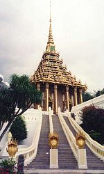
[eedit | eedit soorce]The maist important Buddhist temple is Wat Phra Phutthabat, built unner King Songtham in the 17t century, is locatit aroond a Buddha footprint. It is the maist popular pilgrimage site athin central Thailand.
Close tae that temple, Wat Tham Krabok is famous for its drug detoxification. Additionally it wis the last o the Hmong refugee camps in Thailand.
Seembols
[eedit | eedit soorce]The provincial seal shows the temple Wat Phra Buddha Baat. In the 17t century a hunter foond a puddle o water which leukit like a (owersized) footprint. It wis declared a fuitprint o Buddha, an the temple wis built aroond it. Phra Phutthabat means fuitprint o Buddha.
Provincial tree is Lagerstroemia floribunda, provincial flouer is the Yellow Cotton Tree (Cochlospermum regium).
Admeenistrative diveesions
[eedit | eedit soorce]
The province is subdividit intae 13 destricts (amphoe). The destricts are further subdividit intae 111 communes (tambon) an 965 veelages (muban).
| Wikimedia Commons haes media relatit tae Saraburi. |
