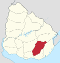
Minas, Uruguay
Minas | |
|---|---|
Caipital ceety | |
| Coordinates: 34°22′0″S 55°14′0″W / 34.36667°S 55.23333°W | |
| Kintra | |
| Depairtment | Lavalleja Depairtment |
| Foondit | 1783 |
| Area | |
| • Total | 8.2 km2 (3.2 sq mi) |
| Elevation | 140 m (460 ft) |
| Population (2011) | |
| • Total | 38,446 |
| • Density | 4,745/km2 (12,290/sq mi) |
| • Demonym | minuano |
| Time zone | UTC -3 |
| Postal code | 30000 |
| Dial plan | +598 444 (+5 digits) |
| Website | lavalleja.gub.uy |
Minas is the caipital o the Lavalleja Depairtment in Uruguay. It is locatit in the sooth o the depairtment, on the intersection o Route 8 wi Route 12. The ceety is situatit atween hill ranges an the basins o the streams Arroyo San Francisco an Arroyo Campanero. As o the census o 2011, it is the twalt maist populatit ceety o the kintra.
History
[eedit | eedit soorce]A toun wis foondit here in 1783 as "Villa de la Concepcion de las Minas", whan a nummer o faimilies frae the Asturias an Galicie regions o Spain settled in the aurie follaein a frustratit attempt tae populate Patagonie. The idea o a ceety in the aurie wis first raised in 1753 bi Jose Joaquin de Viana, the govrenor o Montevideo, who wantit tae creaut a population centre in "the zones o the mines". He commissioned Rafael Perez Del Puerto tae design the layoot o the ceety, the basis o which remains in place the day.
Bi a decree o 8 October 1830, its status wis o "Villa" (toun) an on 16 Juin 1837, bi decree Ley Nº 158, it became the caipital o the "Depairtment o Minas". On 16 Mey 1888, its status wis elevatit tae "Cuidad" (ceety) bi decree Ley Nº 1.980. On 26 Dizember 1927, efter the renamin o the depairtment, it became the caipital o the "Depairtment o Lavalleja" bi decree Ley Nº 8.187.[1]
Population
[eedit | eedit soorce]Accordin tae the 2011 census, the censual aurie o Minas haed a population o 38,446.[2][3]
The follaein auries are considered bi some as pairt o the Minas urban aurie:
- Blanes Viale: 104
- Barrio La Coronilla - Ancap: 301
- San Francisco de las Sierras: 58
As a result, the tot population o the Minas aurie can be said tae be 38,909.
| Year | Population |
|---|---|
| 1908 | 13,345 |
| 1963 | 31,256 |
| 1975 | 35,225 |
| 1985 | 34,658 |
| 1996 | 37,146 |
| 2004 | 37,925 |
| 2011 | 38,446 |
Source: Instituto Nacional de Estadística de Uruguay[1]
Features
[eedit | eedit soorce]- In the ceety
In the northeast pairt o the ceety thare is the big Parque Rodó which contains a zoological gairden, a public open air soummin puil, an aurie for picnics an a sma fitbaa field. At the east end o the ceety is the hill an pairk Cerro Artigas containin a muntit statue o the 19t century Uruguayan hero General Jose Artigas.
- Surroondin aurie
The Parque Salto del Penitente lees 16 kilometre (9.9 mi) east o the ceety, 9 kilometre (5.6 mi) tae the wast-soothwast is Parque Salus an 6 kilometre (3.7 mi) tae the sootheast is the Parque de Vacaciones UTE-ANTEL, a pairk for the vacations o the employees o the Uruguayan Electricity Company an the Uruguayan Telecommunications Company.
Famous fowk
[eedit | eedit soorce]It is the birthplace o:
- Juan Antonio Lavalleja, the revolutionar leader durin Uruguayan unthirldom, efter whom the depairtment is namit.
- Sebastián Abreu, an Uruguayan Association fitbawer.
References
[eedit | eedit soorce]- ↑ a b "Statistics of urban localities (1908–2004)" (PDF). INE. 2012. Archived frae the original (PDF) on 5 November 2012. Retrieved 4 September 2012.
- ↑ "Censos 2011 Cuadros Lavalleja". INE. 2012. Archived frae the original on 10 October 2012. Retrieved 25 August 2012.
- ↑ "Censos 2011 Lavalleja". INE. 2012. Archived frae the original on 23 November 2012. Retrieved 25 August 2012.
Freemit airtins
[eedit | eedit soorce]- Intendencia de Lavelleja - Minas: capital departamental Archived 2020-03-19 at the Wayback Machine
- INE map of Minas and Barrio La Coronilla Archived 2012-10-10 at the Wayback Machine


