Loch Vättern
Appearance
| Loch Vättern | |
|---|---|
 | |
| Coordinates | 58°24′N 14°36′E / 58.400°N 14.600°ECoordinates: 58°24′N 14°36′E / 58.400°N 14.600°E |
| Primar ootflows | Motala ström |
| Catchment area | 4,503 km2 (1,739 sq mi) |
| Basin kintras | Swaden |
| 1,912 km2 (738 sq mi)[1] | |
| Average deepth | 41 m (135 ft)[1] |
| Max. deepth | 128 m (420 ft)[1] |
| 77.0 km3 (18.5 cu mi)[1] | |
| Surface elevation | 88 m (289 ft)[1] |
| Islands | Visingsö |
| Settlements | Vadstena, Jönköping, Hjo, Askersund, Åmmeberg, Karlsborg |
| References | [1] |

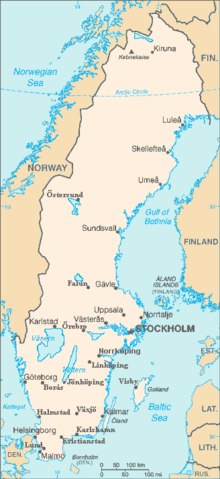
Loch Vättern is the seicont maistmuckle loch (bi surface area) in Swaden, efter Loch Vänern an the saxt maistmuckle loch in Europe. It is a lang, finger-shappit body o fresh watter in sooth central Swaden tae the sootheast o Vänern pyntin at the tip o Scandinavie.
Name
[eedit | eedit soorce]Ane o the etymologies for the name Vättern is fae "vatten", the Swadish wird for watter. This oreegin is, houaniver, unclear an in dispute. It haes forby been suggestit that the archaic term "vätter", meanin forest or loch speerits, is the oreegin o the loch's name.
References
[eedit | eedit soorce]- ↑ a b c d e f Seppälä, Matti (2005). "The Physical Geography of Fennoscandia". Oxford University Press: 145. ISBN 978-0-19-924590-1. Cite journal requires
|journal=(help)
Fremmit airtins
[eedit | eedit soorce]- Loch Vattern Archived 2005-11-21 at the Wayback Machine
| This Swaden-relatit airticle is a stub. Ye can help Wikipaedia bi expandin it. |
