Mount Kilimanjaro
Appearance
(Reguidit frae Kilimanjaro)
| Kilimanjaro | |
|---|---|
 Kibo summit o Kilimanjaro | |
| Heichest pynt | |
| Elevation | 5,895 m (19,341 ft) [1][2] |
| Prominence | 5,885 m (19,308 ft) [3] Ranked 4t |
| Isolation | 5,510 kilometre (3,420 mi) |
| Leetin | |
| Coordinates | 03°04′33″S 37°21′12″E / 3.07583°S 37.35333°ECoordinates: 03°04′33″S 37°21′12″E / 3.07583°S 37.35333°E |
| Geografie | |
| Location | Kilimanjaro Region, Tanzanie |
| Topo map | Kilimanjaro cairt an guide bi Wielochowski[4] |
| Geology | |
| Muntain teep | Stratovolcano |
| Last eruption | Atween 150,000 an 200,000 years ago |
| Climbing | |
| First ascent | 1889 Hans Meyer Ludwig Purtscheller |
| Easiest route | Hike |
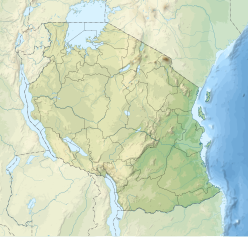
Moont Kilimanjaro /ˌkɪlɪmənˈdʒɑːroʊ/,[5] wi its three volcanic cones, Kibo, Mawenzi, an Shira, is a dormant volcanic moontain in Tanzanie.
References
[eedit | eedit soorce]- ↑ "Mount Kilimanjaro National Park". Tanzania National Parks. Tanzania National Parks. Archived frae the original on 23 September 2012. Retrieved 16 Julie 2015.
- ↑ "Kilimanjaro National Park". World Heritage List. UNESCO World Heritage Centre. Retrieved 16 Julie 2015.
- ↑ "Kilimanjaro". Peakbagger.com. Retrieved 16 August 2012.
- ↑ Kilimanjaro Map and tourist Guide (Map) (4th ed.). 1:75,000 with 1:20,000 and 1:30,000 insets. EWP Map Guides. Cartografie bi EWP. EWP. 2009. ISBN 0-906227-66-6.
- ↑ "Oxford dictionary: definition of Kilimanjaro, Mount (British & World English)". Oxford dictionary. Oxford University Press. Archived frae the original on 9 Julie 2015. Retrieved 16 Julie 2015.

