Andaman an Nicobar Islands
Andaman an Nicobar Isles আন্দামান ও নিকোবর দ্বীপপুঞ্জ (Bengali) | |
|---|---|
 | |
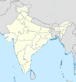
 Location o Andaman an Nicobar Islands | |
| Coordinates (Port Blair): 11°41′N 92°46′E / 11.68°N 92.77°ECoordinates: 11°41′N 92°46′E / 11.68°N 92.77°E | |
| Kintra | |
| Established | 1956-11-01 |
| Caipital an lairgest ceety | Port Blair |
| Destricts | 3 |
| Area | |
| • Total | 8073 km2 (3,117 sq mi) |
| Population (2012)[2] | |
| • Total | 380,500 |
| • Density | 47/km2 (120/sq mi) |
| Time zone | UTC+05:30 (IST) |
| ISO 3166 code | IN-AN |
| HDI | |
| Leids | Offeecial:
Major spoken leids: |
| Website | www |
The Andaman an Nicobar Islands /ˈændəmən/ & /ˈnɪkəbɑːr/ (![]() local (help·info)) are a group o islands at the juncture o the Bay o Bengal an Andaman Sea, an are a Union Territory o Indie.
local (help·info)) are a group o islands at the juncture o the Bay o Bengal an Andaman Sea, an are a Union Territory o Indie.
References[eedit | eedit soorce]
- ↑ "Andaman & Nicobar Administration". And.nic.in. Archived frae the original on 18 Februar 2015. Retrieved 8 Julie 2013.
- ↑ Census of India, 2011. Census Data Online, Population.
- ↑ a b c d e f "Report of the Commissioner for linguistic minorities: 47th report (July 2008 to June 2010)" (PDF). Commissioner for Linguistic Minorities, Ministry of Minority Affairs, Government of India. pp. 122–126. Archived frae the original (PDF) on 13 Mey 2012. Retrieved 16 Februar 2012.

