
File:České Slezsko po roce 1920 na mapě Česka.png
Size o this luikower: 800 × 460 pixels. Ither resolutions: 320 × 184 pixels | 640 × 368 pixels | 1,024 × 588 pixels | 1,280 × 735 pixels | 2,560 × 1,471 pixels | 3,662 × 2,104 pixels.
Oreeginal file (3,662 × 2,104 pixels, file size: 346 KB, MIME type: image/png)
Ootline
| Descreeption |
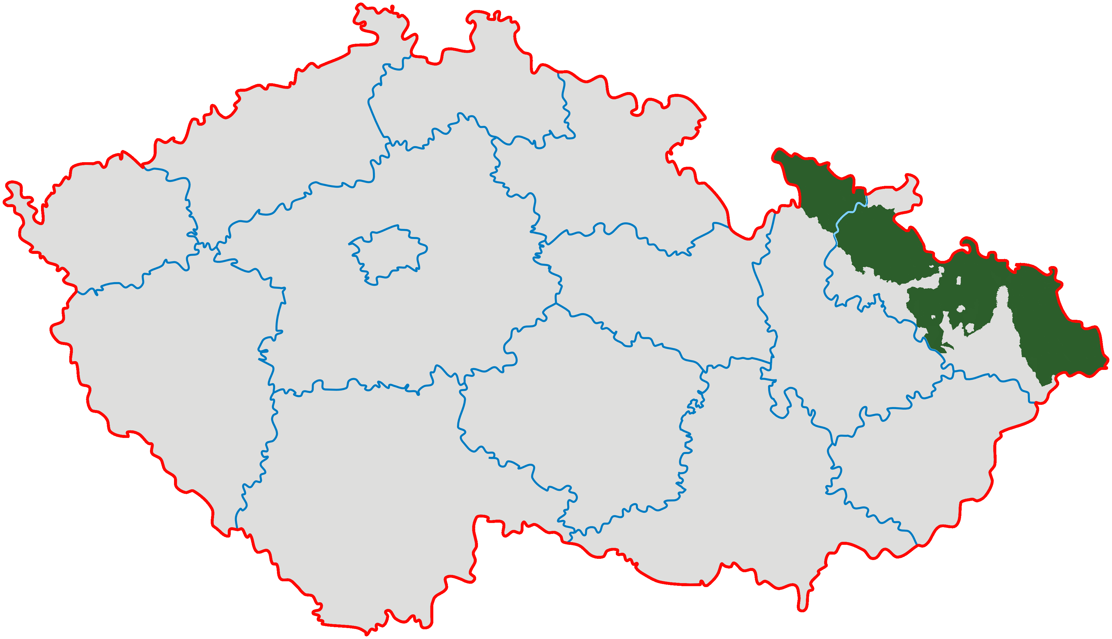
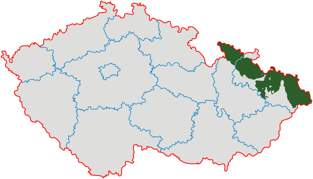
Čeština: *Zeleně je vyznačeno území vlastního Slezska v hranicích od 10. ledna 1920.
English: Czech Silesia (green); Moravian enclaves in Silesia were governed by Silesian authorities till 1928 (after creation of province of Moravia and Silesia they ceased to exist). |
| Soorce | Modified from Image:Cesko-kraje.svg |
| Author | Kirk |
Licensin
I, the copyright holder of this work, hereby publish it under the following licenses:
This file is licensed unner the Creative Commons Attribution-Share Alike 3.0 Unported license.
- Ye are free:
- tae share – tae copy, distribute an transmit the wirk
- tae remix – tae adapt the wirk
- Unner the follaein condeetions:
- attribution – Ye must attribute the wirk in the manner specified bi the author or licensor (but nae in ony way that suggests that thay endorse ye or yer uise o the wirk).
- share alik – If ye alter, transform, or big upon this wirk, ye mey distribute the resultin wirk anly unner the same or seemilar license tae this ane.

|
Permission is grantit tae copy, distribute an/or modify this document unner the terms o the GNU Free Documentation License, Version 1.2 or ony later version published bi the Free Software Foundation; wi no Invariant Sections, no Front-Cover Texts, an no Back-Cover Texts. A copy o the license is includit in the section enteetled GNU Free Documentation License. |
Ye mey select the license o yer choice.
File history
Clap oan ae date/time fer tae see the file aes it kithed at that time.
| Date/Time | Thummnail | Dimensions | Uiser | Comment | |
|---|---|---|---|---|---|
| current | 20:07, 28 Januar 2022 | | 3,662 × 2,104 (346 KB) | Claude Zygiel | Contested status of some little areas (see discussions with GPinkerton): removed red colour |
| 05:40, 26 Januar 2022 |  | 3,662 × 2,104 (633 KB) | GPinkerton | Reverted to version as of 22:09, 13 February 2011 (UTC) COM:CROP Incoherent | |
| 15:13, 15 December 2021 |  | 3,662 × 2,104 (446 KB) | Claude Zygiel | An enclave is landlocked | |
| 03:45, 27 September 2021 |  | 3,662 × 2,104 (633 KB) | GPinkerton | Reverted to version as of 22:09, 13 February 2011 (UTC) COM:CROP | |
| 16:00, 7 Julie 2021 |  | 3,662 × 2,104 (434 KB) | Claude Zygiel | Moravian enclaves/exclaves in Silesia | |
| 22:09, 13 Februar 2011 |  | 3,662 × 2,104 (633 KB) | Carnby | Reverted to version as of 16:44, 3 December 2009 | |
| 22:09, 13 Februar 2011 |  | 3,662 × 2,104 (552 KB) | Carnby | Reverted to version as of 12:01, 23 September 2008 | |
| 16:44, 3 December 2009 |  | 3,662 × 2,104 (633 KB) | Kirk979 | corrected map | |
| 12:01, 23 September 2008 |  | 3,662 × 2,104 (552 KB) | Sevela.p | {{Information |Description= {{cs|České Slezsko po roce 1920 na mapě Česka}} |Source= *Modified from Image:Cesko-kraje.svg *Transferred from [http://cs.wikipedia.org cs.wikipedia]; transferred to Commons by User:Sevela.p using [http://tools.wi |
Eimage airtins
The'r nae pages airts tae this eimage.
Global file uisage
The follaein ither wikis uise this file:
- Uisage on af.wikipedia.org
- Uisage on bg.wikipedia.org
- Uisage on cs.wikipedia.org
- Uisage on en.wikipedia.org
- Uisage on eo.wikipedia.org
- Uisage on fi.wikipedia.org
- Uisage on fr.wikipedia.org
- Uisage on id.wikipedia.org
- Uisage on ja.wikipedia.org
- Uisage on ka.wikipedia.org
- Uisage on lt.wikipedia.org
- Uisage on lv.wikipedia.org
- Uisage on nl.wikipedia.org
- Uisage on pl.wikipedia.org
- Uisage on pnb.wikipedia.org
- Uisage on pt.wikipedia.org
- Uisage on ro.wikipedia.org
- Uisage on sh.wikipedia.org
- Uisage on sk.wikipedia.org
- Uisage on sr.wikipedia.org
- Uisage on tl.wikipedia.org
- Uisage on uk.wikipedia.org
- Uisage on ur.wikipedia.org
View mair global usage o this file.