
File:Sweden Blekinge location map.svg

Size of this PNG preview of this SVG file: 800 × 398 pixels. Ither resolutions: 320 × 159 pixels | 640 × 319 pixels | 1,024 × 510 pixels | 1,280 × 637 pixels | 2,560 × 1,275 pixels | 1,000 × 498 pixels.
Oreeginal file (SVG file, nominallie 1,000 × 498 pixels, file size: 166 KB)
Ootline
| Descreeption |
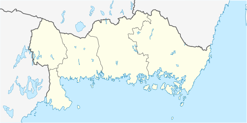
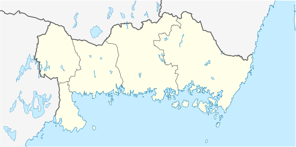
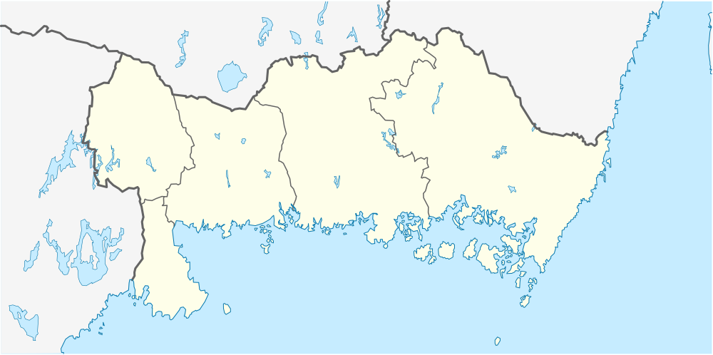
English: Location map of Blekinge County in Sweden
Equirectangular projection, N/S stretching 182 %. Geographic limits of the map:
Deutsch: Positionskarte von Blekinge län in Schweden
Quadratische Plattkarte, N-S-Streckung 182 %. Geographische Begrenzung der Karte:
|
| Date | |
| Soorce | Ain wirk |
| Author | Erik Frohne |
Licensin
I, the copyright holder of this work, hereby publish it under the following licenses:

|
Permission is grantit tae copy, distribute an/or modify this document unner the terms o the GNU Free Documentation License, Version 1.2 or ony later version published bi the Free Software Foundation; wi no Invariant Sections, no Front-Cover Texts, an no Back-Cover Texts. A copy o the license is includit in the section enteetled GNU Free Documentation License. |
This file is licensed under the Creative Commons Attribution 3.0 Unported license.
- Ye are free:
- tae share – tae copy, distribute an transmit the wirk
- tae remix – tae adapt the wirk
- Unner the follaein condeetions:
- attribution – Ye must attribute the wirk in the manner specified bi the author or licensor (but nae in ony way that suggests that thay endorse ye or yer uise o the wirk).
Ye mey select the license o yer choice.
File history
Clap oan ae date/time fer tae see the file aes it kithed at that time.
| Date/Time | Thummnail | Dimensions | Uiser | Comment | |
|---|---|---|---|---|---|
| current | 17:42, 26 Januar 2009 | | 1,000 × 498 (166 KB) | Erik Frohne | Smaller waterborder |
| 23:07, 17 Januar 2009 |  | 1,000 × 498 (150 KB) | Erik Frohne | {{Information |Description= |Source= |Date= |Author= |Permission= |other_versions= }} Category:Location maps of Sweden | |
| 08:49, 2 Januar 2009 |  | 153 × 80 (67 KB) | Erik Frohne | {{Information |Description=Update (gray out other län) |Source=Own work |Date=02-Jan-2009 |Author=Erik Frohne |Permission=see below |other_versions= }} | |
| 20:08, 1 Januar 2009 |  | 153 × 80 (29 KB) | Erik Frohne | {{Information |Description=Addition of municipiality |Source=Own work |Date=01-01-2009 |Author=Erik Frohne |Permission= |other_versions= }} Category:Location maps of Europe | |
| 17:14, 1 Januar 2009 |  | 153 × 80 (23 KB) | Erik Frohne | {{Information |Description={{en|1=Location map of Blekinge in Sweden Equirectangular projection, N/S stretching 190 %. Geographic limits of the map: * N: 56° 33' N * S: 55° 56' N * W: 14° 08' E * E: 16° 23' E }} {{de|1=Positionskarte von Schonen |
Eimage airtins
The follaein pages airts tae this image:
Global file uisage
The follaein ither wikis uise this file:
- Uisage on ar.wikipedia.org
- Uisage on bg.wikipedia.org
- Uisage on ceb.wikipedia.org
- Uisage on cs.wikipedia.org
- Uisage on da.wikipedia.org
- Karlskrona
- Ronneby
- Karlshamn
- Olofström
- Sölvesborg
- Kristianopel
- Elleholm
- Sølvesborg Slotsruin
- Lyckeby
- Nättraby
- Brömsebro
- Skabelon:Kortpositioner Sverige Blekinge
- Bräkne-Hoby
- Järnavik
- Rödeby
- Drottningskär
- Fridlevstad
- Fågelmara
- Hasslö
- Holmsjö
- Jämjö
- Kättilsmåla
- Torhamn
- Mörrum
- Hällaryd
- Mjällby
- Svängsta
- Trolleboda (Ronneby kommun)
- Backaryd
- Åryd (Blekinge)
- Bruger:DykplatserISverige/Vragkirkegården ved Ekenabben
- Uisage on de.wikipedia.org
View mair global usage o this file.