
File:Stewart Island map-en.svg

Size of this PNG preview of this SVG file: 800 × 585 pixels. Ither resolutions: 320 × 234 pixels | 640 × 468 pixels | 1,024 × 748 pixels | 1,280 × 936 pixels | 2,560 × 1,871 pixels | 2,237 × 1,635 pixels.
Oreeginal file (SVG file, nominallie 2,237 × 1,635 pixels, file size: 1.7 MB)
Ootline
| Descreeption |
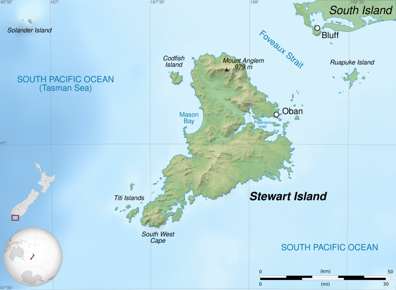
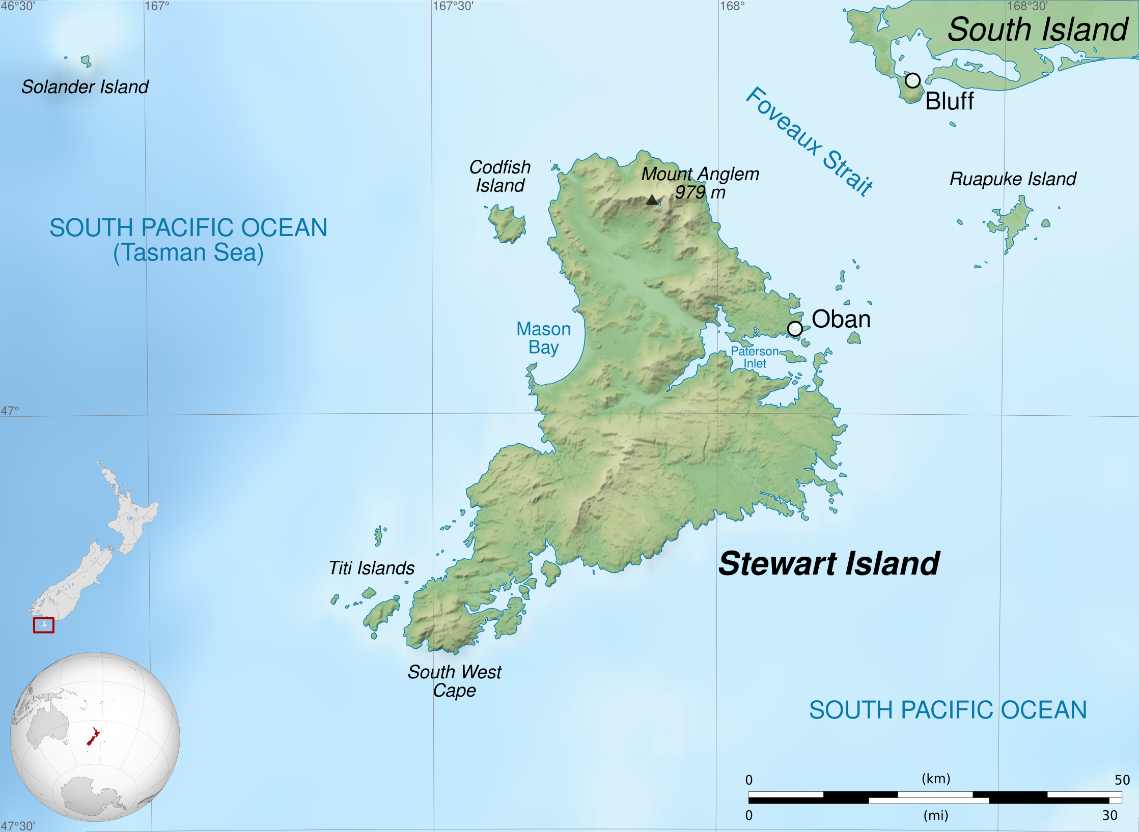
English: Map of Stewart Island / Rakiura, New Zealand.
Geographic limits of the map:
Français : Carte de l'île Stewart, au sud de la Nouvelle-Zélande.
Limites géographiques de la carte :
|
||
| Date | |||
| Soorce |
Ain wirk. English:
Français : |
||
| Author | Sémhur (talk) | ||
| Other versions |
| ||
| Attribution (required by the license) | © Sémhur / Wikimedia Commons / | ||
| SVG | W3C-validity not checked.
|
||
| Graphic Lab |


| Camera location | | View this and other nearby images on: OpenStreetMap |
|---|
Licensin
I, the copyright holder of this work, hereby publish it under the following licenses:
| Copyleft: This wairk o airt is free; ye can redistreebute it n/or modifie it accordin til the terms o the Free Art License. Ye'll fynd ae specimen o this license oan the Copyleft Attitude steid aes weel aes oan ither steids. |
This file is licensed under the Creative Commons Attribution-Share Alike Attribution-Share Alike 4.0 International, 3.0 Unported, 2.5 Generic, 2.0 Generic and 1.0 Generic license.
- Ye are free:
- tae share – tae copy, distribute an transmit the wirk
- tae remix – tae adapt the wirk
- Unner the follaein condeetions:
- attribution – Ye must attribute the wirk in the manner specified bi the author or licensor (but nae in ony way that suggests that thay endorse ye or yer uise o the wirk).
- share alik – If ye alter, transform, or big upon this wirk, ye mey distribute the resultin wirk anly unner the same or seemilar license tae this ane.
Ye mey select the license o yer choice.
File history
Clap oan ae date/time fer tae see the file aes it kithed at that time.
| Date/Time | Thummnail | Dimensions | Uiser | Comment | |
|---|---|---|---|---|---|
| current | 21:39, 3 Februar 2020 | | 2,237 × 1,635 (1.7 MB) | Sémhur | Correct scale |
| 07:58, 2 Juin 2014 |  | 2,237 × 1,635 (1.7 MB) | Sémhur | Valid SVG | |
| 21:22, 27 Apryle 2011 |  | 2,237 × 1,635 (1.7 MB) | Sémhur | == {{int:filedesc}} == {{Information |Description={{Multilingual description |en=Map of en:Stewart Island / Rakiura, New Zealand. * Altitude levels: 50 m, 125, 250, 500, etc. (same for bathymetry). * Projection: New Zealand Geodetic Datum 2000 ; GRS |
Eimage airtins
The'r nae pages airts tae this eimage.
Global file uisage
The follaein ither wikis uise this file:
- Uisage on ast.wikipedia.org
- Uisage on bn.wikipedia.org
- Uisage on br.wikipedia.org
- Uisage on de.wikipedia.org
- Uisage on en.wikipedia.org
- Uisage on fa.wikipedia.org
- Uisage on fi.wikipedia.org
- Uisage on gl.wikipedia.org
- Uisage on hu.wikipedia.org
- Uisage on kw.wikipedia.org
- Uisage on lt.wikipedia.org
- Uisage on lv.wikipedia.org
- Uisage on ml.wikipedia.org
- Uisage on nl.wikipedia.org
- Uisage on no.wikipedia.org
- Uisage on pl.wikipedia.org
- Uisage on simple.wikipedia.org
- Uisage on sl.wikipedia.org
- Uisage on sv.wikipedia.org
- Uisage on ta.wikipedia.org
- Uisage on th.wikipedia.org
- Uisage on uk.wikipedia.org
- Uisage on vi.wikipedia.org
- Uisage on zh.wikipedia.org