
File:South Sudan topographic map.svg

Size of this PNG preview of this SVG file: 800 × 577 pixels. Ither resolutions: 320 × 231 pixels | 640 × 462 pixels | 1,024 × 738 pixels | 1,280 × 923 pixels | 2,560 × 1,846 pixels | 1,553 × 1,120 pixels.
Oreeginal file (SVG file, nominallie 1,553 × 1,120 pixels, file size: 759 KB)
Ootline
| Descreeption |
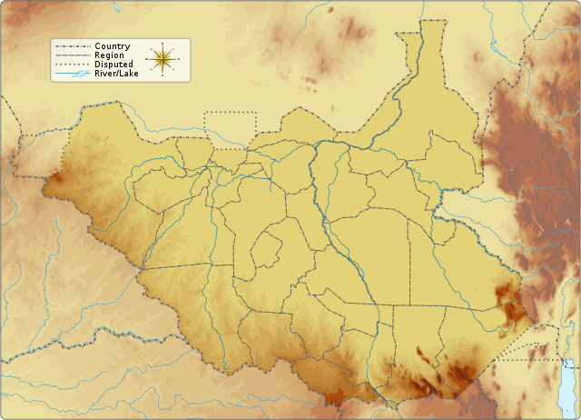
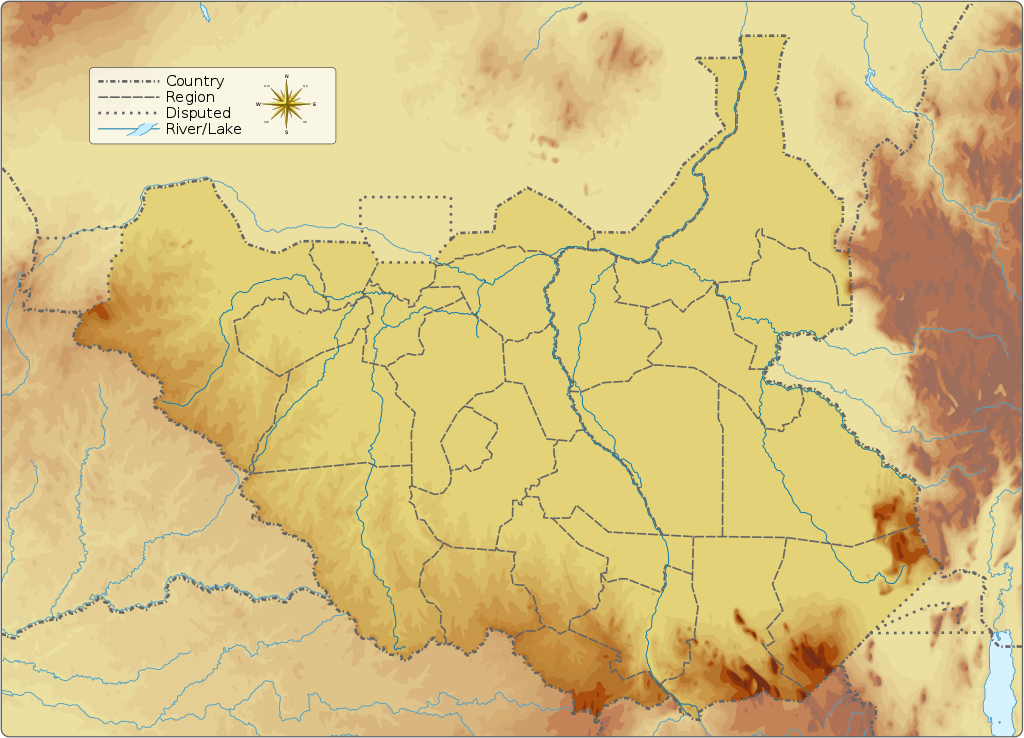
English: Topographic map of South Sudan.
|
|||||||||||||||||||
| Date | ||||||||||||||||||||
| Soorce |
Ain wirk Information from:
|
|||||||||||||||||||
| Author | Goran_tek-en | |||||||||||||||||||
| Permission (Reuisin this file) |
This file is licensed under the Creative Commons Attribution-Share Alike 4.0 International license. Attribution: Goran tek-en
|
|||||||||||||||||||
| Other versions |
|
|||||||||||||||||||
| SVG genesis | This vector image was created with Inkscape.
|
|||||||||||||||||||

| Object location | | View this and other nearby images on: OpenStreetMap |
|---|


Licensin
This file is licensed under the Creative Commons Attribution-Share Alike 4.0 International license.
Attribution: Goran tek-en
- Ye are free:
- tae share – tae copy, distribute an transmit the wirk
- tae remix – tae adapt the wirk
- Unner the follaein condeetions:
- attribution – Ye must attribute the wirk in the manner specified bi the author or licensor (but nae in ony way that suggests that thay endorse ye or yer uise o the wirk).
- share alik – If ye alter, transform, or big upon this wirk, ye mey distribute the resultin wirk anly unner the same or seemilar license tae this ane.
File history
Clap oan ae date/time fer tae see the file aes it kithed at that time.
| Date/Time | Thummnail | Dimensions | Uiser | Comment | |
|---|---|---|---|---|---|
| current | 15:32, 5 September 2016 | | 1,553 × 1,120 (759 KB) | Goran tek-en | User created page with UploadWizard |
Eimage airtins
The follaein pages airts tae this image:
Global file uisage
The follaein ither wikis uise this file:
- Uisage on ab.wikipedia.org
- Uisage on ar.wikipedia.org
- Uisage on ast.wikipedia.org
- Uisage on av.wikipedia.org
- Uisage on az.wikipedia.org
- Uisage on be.wikipedia.org
- Uisage on bn.wikipedia.org
- Uisage on bs.wikipedia.org
- Uisage on ceb.wikipedia.org
- Uisage on ce.wikipedia.org
- Uisage on cs.wikipedia.org
- Uisage on de.wikivoyage.org
- Uisage on din.wikipedia.org
- Uisage on dsb.wikipedia.org
- Uisage on el.wikipedia.org
- Uisage on en.wikipedia.org
- Kidepo River
- Kinyeti
- Lake No
- Bahr el Zeraf
- Pibor River
- Akobo River
- Jur River
- Unity oilfield
- Jikawo River
- Yabus River
- Boma National Park
- Nimule National Park
- Lantoto National Park
- Mbarizunga Game Reserve
- Bengangai Game Reserve
- Southern National Park
- Shambe National Park
- Chelkou Game Reserve
- Imatong Mountains
- Kongkong River
- Kangen River
- Lotilla River
- Kuru River
- Pongo River (South Sudan)
- Wau River
- Didinga Hills
View mair global usage o this file.