
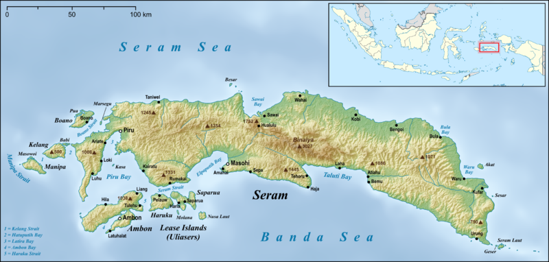
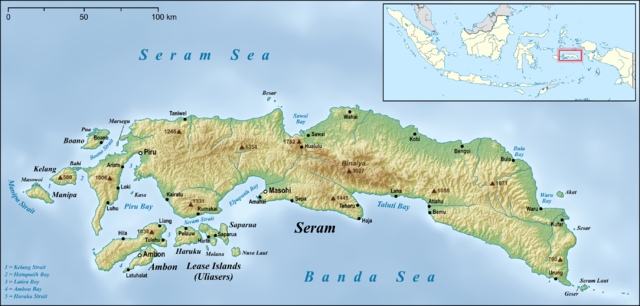
File:Seram en.png

Size o this luikower: 800 × 382 pixels. Ither resolutions: 320 × 153 pixels | 640 × 306 pixels | 1,024 × 489 pixels | 1,280 × 612 pixels | 2,756 × 1,317 pixels.
Oreeginal file (2,756 × 1,317 pixels, file size: 2.59 MB, MIME type: image/png)
Ootline
| Descreeption | |
| Date | |
| Soorce |
own work, used:
|
| Author | Lencer |
| Other versions |
|


|
This map has been made or improved in the German Kartenwerkstatt (Map Lab). You can propose maps to improve as well.
|
Licensin
I, the copyright holder of this work, hereby publish it under the following license:
This file is licensed unner the Creative Commons Attribution-Share Alike 3.0 Unported license.
- Ye are free:
- tae share – tae copy, distribute an transmit the wirk
- tae remix – tae adapt the wirk
- Unner the follaein condeetions:
- attribution – Ye must attribute the wirk in the manner specified bi the author or licensor (but nae in ony way that suggests that thay endorse ye or yer uise o the wirk).
- share alik – If ye alter, transform, or big upon this wirk, ye mey distribute the resultin wirk anly unner the same or seemilar license tae this ane.
File history
Clap oan ae date/time fer tae see the file aes it kithed at that time.
| Date/Time | Thummnail | Dimensions | Uiser | Comment | |
|---|---|---|---|---|---|
| current | 05:05, 18 Juin 2015 | | 2,756 × 1,317 (2.59 MB) | Lencer | small fix |
| 06:22, 17 Juin 2015 |  | 2,756 × 1,317 (2.59 MB) | Lencer | small fixes | |
| 05:42, 17 Juin 2015 |  | 2,756 × 1,317 (2.59 MB) | Lencer | == {{int:filedesc}} == {{Information |Description= {{en|Map of Seram Island and also Ambon Island and Lease Islands}} {{de|Karte der Insel Seram, sowie [[:de:Ambon (Insel)|Am... |
Eimage airtins
The'r nae pages airts tae this eimage.
Global file uisage
The follaein ither wikis uise this file:
- Uisage on af.wikipedia.org
- Uisage on ar.wikipedia.org
- Uisage on ast.wikipedia.org
- Uisage on be.wikipedia.org
- Uisage on bg.wikipedia.org
- Uisage on bn.wikipedia.org
- Uisage on ca.wikipedia.org
- Uisage on ceb.wikipedia.org
- Uisage on cs.wikipedia.org
- Uisage on cy.wikipedia.org
- Uisage on da.wikipedia.org
- Uisage on de.wikipedia.org
- Uisage on el.wikipedia.org
- Uisage on en.wikipedia.org
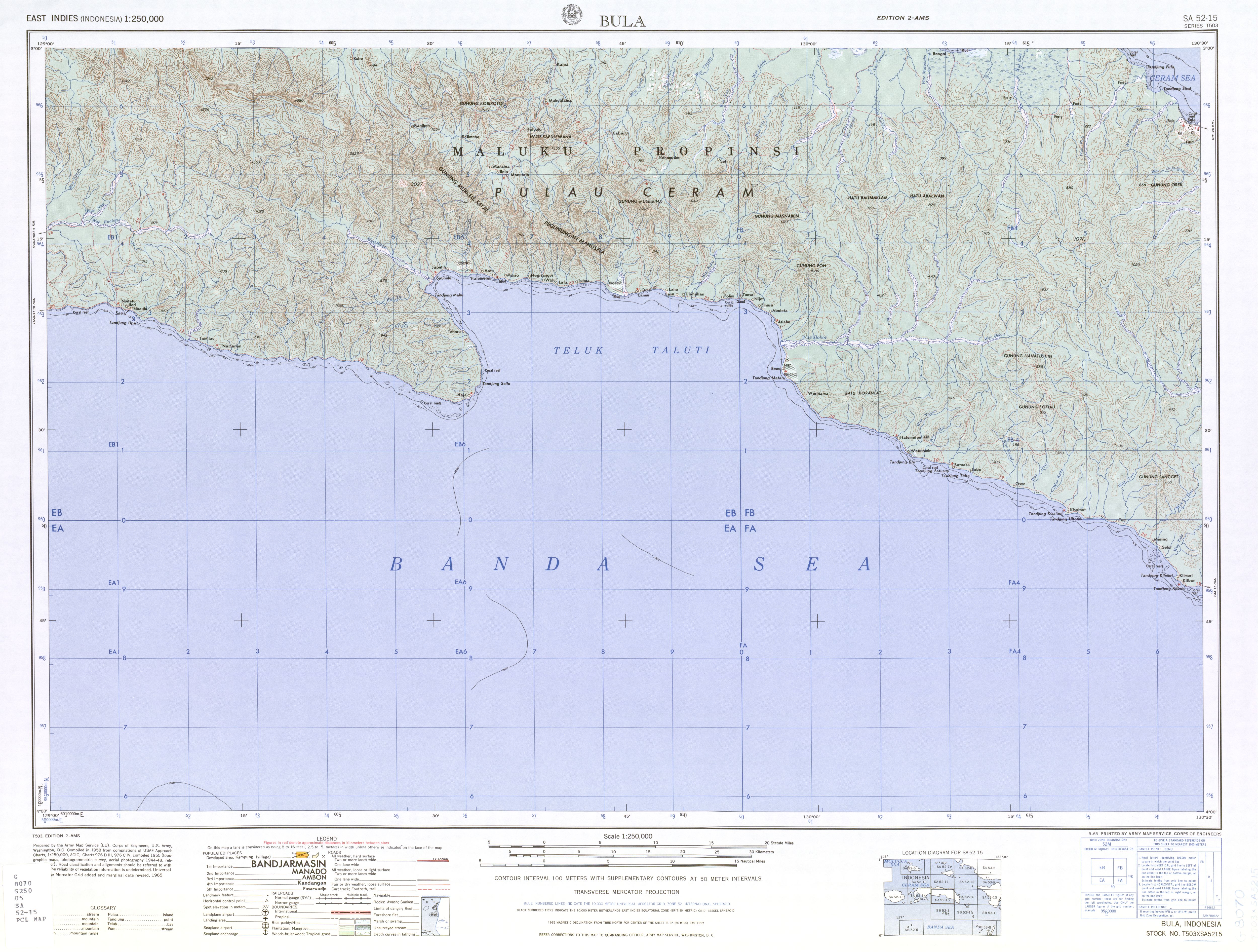
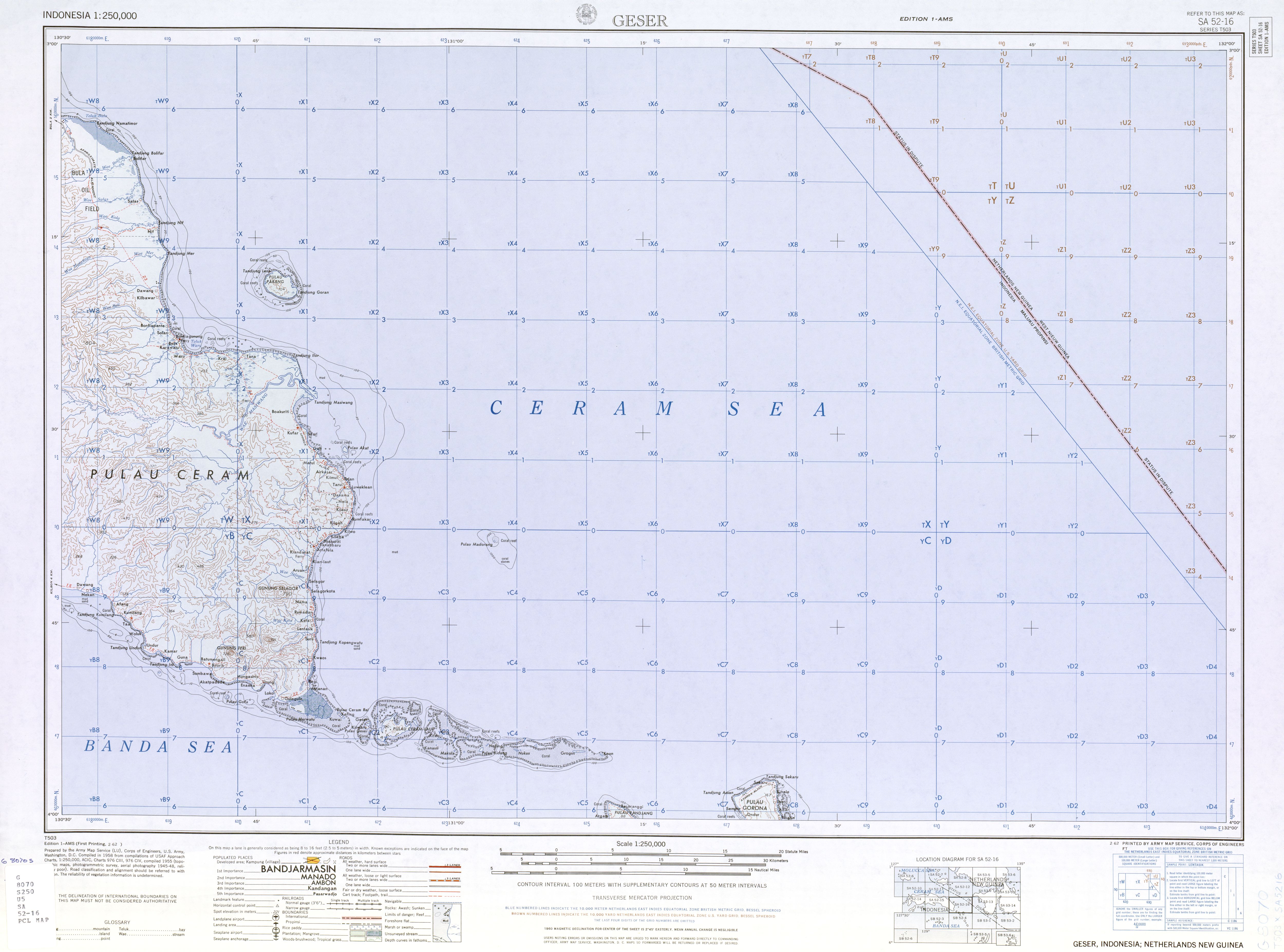
- Seram Island
- Pattimura International Airport
- Streak-breasted fantail
- Central Maluku Regency
- West Seram Regency
- East Seram Regency
- Masohi
- Tehoru
- Boano
- Masiwang River
- Kawa River
- Sapalewa River
- Tala River
- Salawai River
- Bengoi
- Bula, Indonesia
- Taniwel
- Piru, Indonesia
- Kairatu
- Ariate
- Luhu, Indonesia
- Kulur, Indonesia
- Loki, Indonesia
- Module:Location map/data/Indonesia Seram/doc
- Amahai
- Atiahu
- Bemu
- Wikipedia:Graphics Lab/Map workshop/Archive/Jun 2015
View mair global usage o this file.