
File:Republic of Artsakh (orthographic projection) v1.png
Size o this luikower: 603 × 599 pixels. Ither resolutions: 242 × 240 pixels | 617 × 613 pixels.
Oreeginal file (617 × 613 pixels, file size: 120 KB, MIME type: image/png)
_v1.png)
| Descreeption |
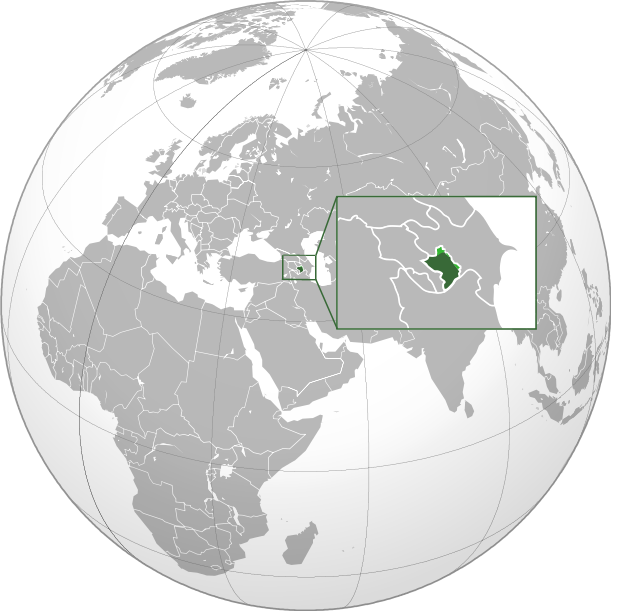
English: Orthographic Projection Map of the Nagorno-Karabakh Republic Dark Green represents areas under ethnic Armenian military control, light green represents areas claimed by the republic, under Azerbaijan government control. |
| Date | (UTC) |
| Soorce | |
| Author |
|
.svg)
| This is a retouched picture, which means that it has been digitally altered from its original version. Modifications: made the location of NKR more clear on the world map. The original can be viewed here: Nagorno-Karabakh Republic (orthographic projection).svg:
|
| This work is ineligible for copyright and therefore in the public domain because it consists entirely of information that is common property and contains no original authorship. |
Original upload log
This image is a derivative work of the following images:
- File:Nagorno-Karabakh_Republic_(orthographic_projection).svg licensed with PD-ineligible
- 2010-02-23T00:53:47Z Kentronhayastan 550x550 (594491 Bytes) cleaned up the fixed borders
- 2010-02-21T11:04:39Z Dinamik 550x550 (655950 Bytes) some more information about territory
- 2010-02-12T12:42:58Z Justass 550x550 (586396 Bytes) Reverted to version as of 10:24, 27 January 2010
- 2010-02-12T12:40:31Z Maulucioni 550x550 (105958 Bytes) to png
- 2010-01-27T10:24:54Z Kentronhayastan 550x550 (586396 Bytes) adjusted map size
- 2010-01-27T10:19:16Z Kentronhayastan 550x550 (586344 Bytes) {{Information |Description={{en|1=Orthographic Projection Map of the Nagorno-Karabakh Republic}} |Source=Ssolbergj's work |Author=kentronhayastan, Ssolbergj |Date= |Permission= |other_versions= }}
Uploaded with derivativeFX
File history
Clap oan ae date/time fer tae see the file aes it kithed at that time.
| Date/Time | Thummnail | Dimensions | Uiser | Comment | |
|---|---|---|---|---|---|
| current | 18:46, 11 Januar 2011 | | 617 × 613 (120 KB) | Ashot Arzumanyan | {{Information |Description={{en|1=Orthographic Projection Map of the Nagorno-Karabakh Republic}} Dark Green represents areas under ethnic Armenian military control, light green represents areas claimed by the republic, under Azerbaijan government control. |
Eimage airtins
The'r nae pages airts tae this eimage.
Global file uisage
The follaein ither wikis uise this file:
- Uisage on en.wikipedia.org
- Uisage on fa.wikipedia.org
- Uisage on hy.wikipedia.org
_v1.png)