
File:Relief Map of Kemerovo Oblast.jpg

Size o this luikower: 418 × 600 pixels. Ither resolutions: 167 × 240 pixels | 334 × 480 pixels | 535 × 768 pixels | 1,200 × 1,722 pixels.
Oreeginal file (1,200 × 1,722 pixels, file size: 540 KB, MIME type: image/jpeg)
Ootline
| Descreeption |
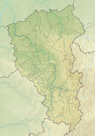
Русский: Физическая карта Кемеровской области
|top = 57 |bottom = 52 |left = 84 |right = 90 |
| Date | |
| Soorce | |
| Author | |
| Other versions |
[] |


Licensin
This file is licensed under the Creative Commons Attribution-Share Alike 2.0 Generic license.
- Ye are free:
- tae share – tae copy, distribute an transmit the wirk
- tae remix – tae adapt the wirk
- Unner the follaein condeetions:
- attribution – Ye must attribute the wirk in the manner specified bi the author or licensor (but nae in ony way that suggests that thay endorse ye or yer uise o the wirk).
- share alik – If ye alter, transform, or big upon this wirk, ye mey distribute the resultin wirk anly unner the same or seemilar license tae this ane.
File history
Clap oan ae date/time fer tae see the file aes it kithed at that time.
| Date/Time | Thummnail | Dimensions | Uiser | Comment | |
|---|---|---|---|---|---|
| current | 08:33, 27 November 2010 | | 1,200 × 1,722 (540 KB) | Виктор В | == {{int:filedesc}} == {{Information |Description={{ru|1=Физическая карта Кемеровской области *Проекция — равноугольная. *Стандартная параллель — 54°30′00″с.ш. *Пара� |
Eimage airtins
The follaein pages airts tae this image:
Global file uisage
The follaein ither wikis uise this file:
- Uisage on ar.wikipedia.org
- Uisage on be.wikipedia.org
- Uisage on bg.wikipedia.org
- Яя (Русия)
- Яшкино
- Новокузнецк
- Кемерово
- Прокопевск
- Шаблон:ПК Русия Кемеровска област
- Белово (Кемеровска област)
- Гуревск (Кемеровска област)
- Калтан
- Мариинск
- Междуреченск (Кемеровска област)
- Осинники
- Полисаево
- Салаир
- Тайга (град)
- Тащагол
- Топки
- Юрга
- Кузнецки Алатау
- Кузнецка котловина
- Салаирско възвишение
- Uisage on ceb.wikipedia.org
- Uisage on ce.wikipedia.org
- Uisage on cs.wikipedia.org
- Uisage on cv.wikipedia.org
- Uisage on da.wikipedia.org
- Uisage on de.wikipedia.org
- Uisage on el.wikipedia.org
- Uisage on en.wikipedia.org
- Uisage on eo.wikipedia.org
View mair global usage o this file.