
File:Philippines relief location map (Palawan).svg

Size of this PNG preview of this SVG file: 377 × 377 pixels. Ither resolutions: 240 × 240 pixels | 480 × 480 pixels | 768 × 768 pixels | 1,024 × 1,024 pixels | 2,048 × 2,048 pixels.
Oreeginal file (SVG file, nominallie 377 × 377 pixels, file size: 2.21 MB)
.svg)
Ootline
| Descreeption |
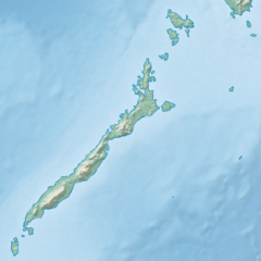
English: Physical location map of the Philippines (Palawan)
Equirectangular projection based on the parallel of 10°43' N
|
| Date | |
| Soorce | File:Philippines location map (square).svg |
| Author | User:Hellerick |
| Other versions |
This file was derived from: Philippines relief location map (square).svg: .svg) |
.svg)
Licensin
This file is licensed unner the Creative Commons Attribution-Share Alike 3.0 Unported license.
- Ye are free:
- tae share – tae copy, distribute an transmit the wirk
- tae remix – tae adapt the wirk
- Unner the follaein condeetions:
- attribution – Ye must attribute the wirk in the manner specified bi the author or licensor (but nae in ony way that suggests that thay endorse ye or yer uise o the wirk).
- share alik – If ye alter, transform, or big upon this wirk, ye mey distribute the resultin wirk anly unner the same or seemilar license tae this ane.
File history
Clap oan ae date/time fer tae see the file aes it kithed at that time.
| Date/Time | Thummnail | Dimensions | Uiser | Comment | |
|---|---|---|---|---|---|
| current | 17:23, 26 October 2017 | | 377 × 377 (2.21 MB) | Mliu92 | User created page with UploadWizard |
Eimage airtins
The'r nae pages airts tae this eimage.
Global file uisage
The follaein ither wikis uise this file:
- Uisage on ban.wikipedia.org
- Uisage on bcl.wikipedia.org
- Uisage on en.wikipedia.org
- Busuanga Island
- Tubbataha Reef
- Calamian Islands
- Puerto Princesa Subterranean River National Park
- Mindoro Strait
- Balabac Island
- Mangarin Bay
- Mount Mantalingajan
- Honda Bay
- Calauit Island
- Rasa Island
- Malampaya Sound
- Delian Island
- Module:Location map/data/Palawan
- Module:Location map/data/Palawan/doc
- Bacungan River
- Uisage on fa.wikipedia.org
- Uisage on fr.wikipedia.org
- Uisage on id.wikipedia.org
- Uisage on ilo.wikipedia.org
- Uisage on lv.wikipedia.org
- Uisage on ml.wikipedia.org
- Uisage on si.wikipedia.org
- Uisage on uz.wikipedia.org
.svg)